Approximate Location Map
Large Map »
Latitude: 51.4302 / 51°25'48"N
Longitude: 0.212 / 0°12'43"E
OS Eastings: 553866
OS Northings: 172451
OS Grid: TQ538724
Mapcode National: GBR TP.Q3N
Mapcode Global: VHHP0.M9FZ
Plus Code: 9F32C6J6+3Q
Entry Name: Tomb to William Hobbs in Churchyard to South East of Church of St Michael
Listing Date: 17 March 1982
Grade: II
Source: Historic England
Source ID: 1101744
English Heritage Legacy ID: 172745
ID on this website: 101101744
Location: St Michael's Church, Wilmington, Dartford, Kent, DA2
County: Kent
District: Dartford
Civil Parish: Wilmington
Built-Up Area: Bexley
Traditional County: Kent
Lieutenancy Area (Ceremonial County): Kent
Church of England Parish: Wilmington St Michael
Church of England Diocese: Rochester
Tagged with: Building
1.
5274 WILMINGTON CHURCH HILL
(north-west side)
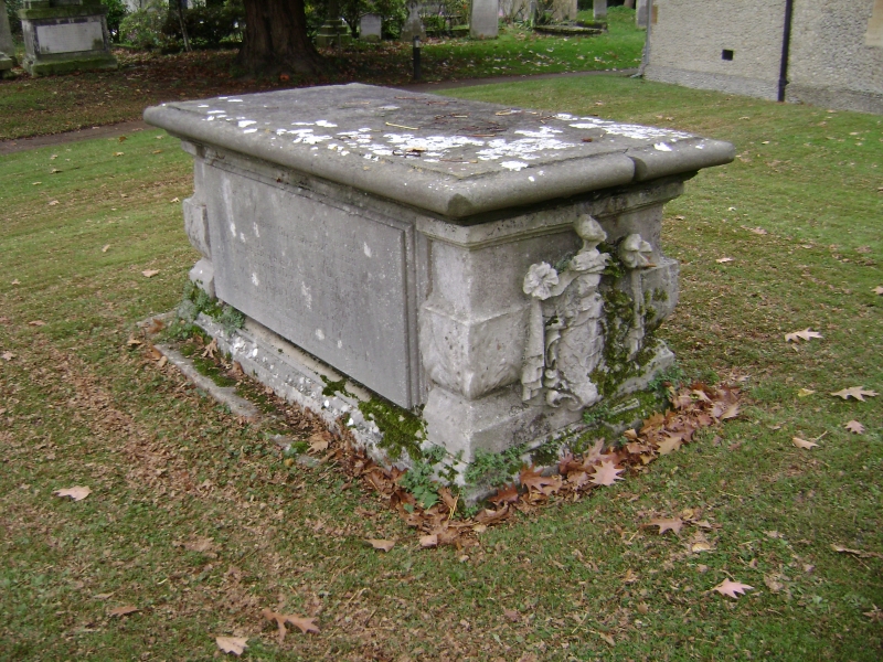
Tomb to William Hobbs in
churchyard to south-east
of church of St Michael
TQ 57 SW 3/108
II
2.
William Hobbs (died 1685) was a London Physician. Stone chest tomb with armorial
bearings at one end.
Listing NGR: TQ5389272434
External links are from the relevant listing authority and, where applicable, Wikidata. Wikidata IDs may be related buildings as well as this specific building. If you want to add or update a link, you will need to do so by editing the Wikidata entry.


Other nearby listed buildings
