Approximate Location Map
Large Map »
Latitude: 51.4328 / 51°25'58"N
Longitude: 0.2155 / 0°12'55"E
OS Eastings: 554101
OS Northings: 172755
OS Grid: TQ541727
Mapcode National: GBR TP.K0H
Mapcode Global: VHHP0.P78X
Plus Code: 9F32C6M8+45
Entry Name: 17, Church Hill
Listing Date: 17 March 1982
Grade: II
Source: Historic England
Source ID: 1085791
English Heritage Legacy ID: 172749
ID on this website: 101085791
Location: Brooklands, Dartford, Kent, DA2
County: Kent
District: Dartford
Civil Parish: Wilmington
Built-Up Area: Bexley
Traditional County: Kent
Lieutenancy Area (Ceremonial County): Kent
Church of England Parish: Wilmington St Michael
Church of England Diocese: Rochester
Tagged with: Building
1.
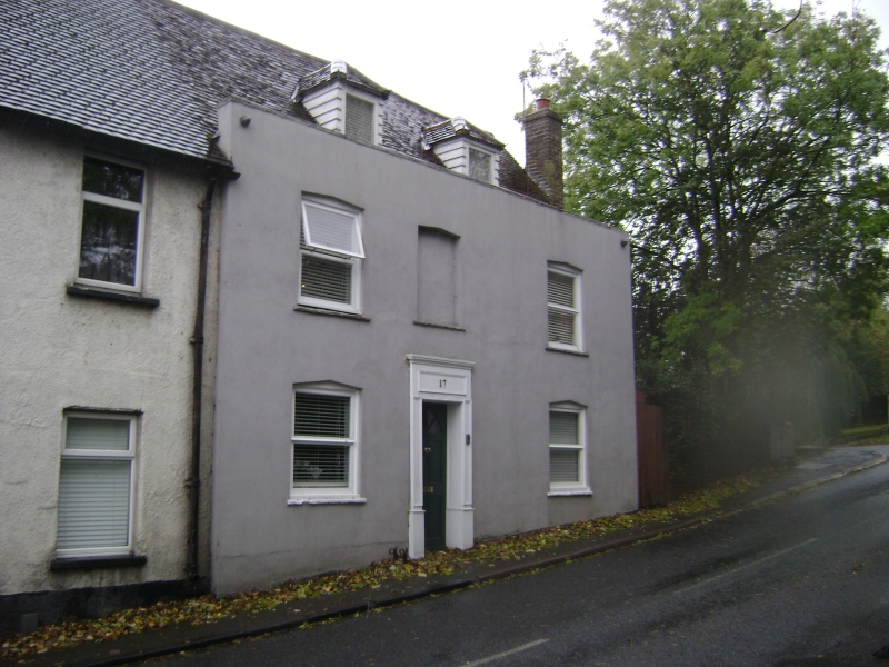
5274 WILMINGTON CHURCH HILL
(south-east side)
No 17
TQ 57 SW 3/112
II
2.
C18. Two storeys and attics cement rendered. Parapet. Tiled roof with 2 hipped
dormers. Three sashes with glazing bars including central blank. Cambered head
linings. Simple central doorcase with cornice and pilasters.
Listing NGR: TQ5410172755
External links are from the relevant listing authority and, where applicable, Wikidata. Wikidata IDs may be related buildings as well as this specific building. If you want to add or update a link, you will need to do so by editing the Wikidata entry.


Other nearby listed buildings
