Approximate Location Map
Large Map »
Latitude: 51.4272 / 51°25'37"N
Longitude: 0.2032 / 0°12'11"E
OS Eastings: 553267
OS Northings: 172097
OS Grid: TQ532720
Mapcode National: GBR TP.V6S
Mapcode Global: VHHP0.GDS9
Plus Code: 9F32C6G3+V7
Entry Name: The Retreat
Listing Date: 23 September 1981
Grade: II
Source: Historic England
Source ID: 1085792
English Heritage Legacy ID: 172753
ID on this website: 101085792
Location: Wilmington, Dartford, Kent, DA2
County: Kent
District: Dartford
Civil Parish: Wilmington
Built-Up Area: Bexley
Traditional County: Kent
Lieutenancy Area (Ceremonial County): Kent
Church of England Parish: Wilmington St Michael
Church of England Diocese: Rochester
Tagged with: Building
1.
5274 WILMINGTON HIGH ROAD
(south side)
Nos 157 to 165 (odd)
(The Retreat)
TQ 57 SW 3/116 23.9.81
II
2.
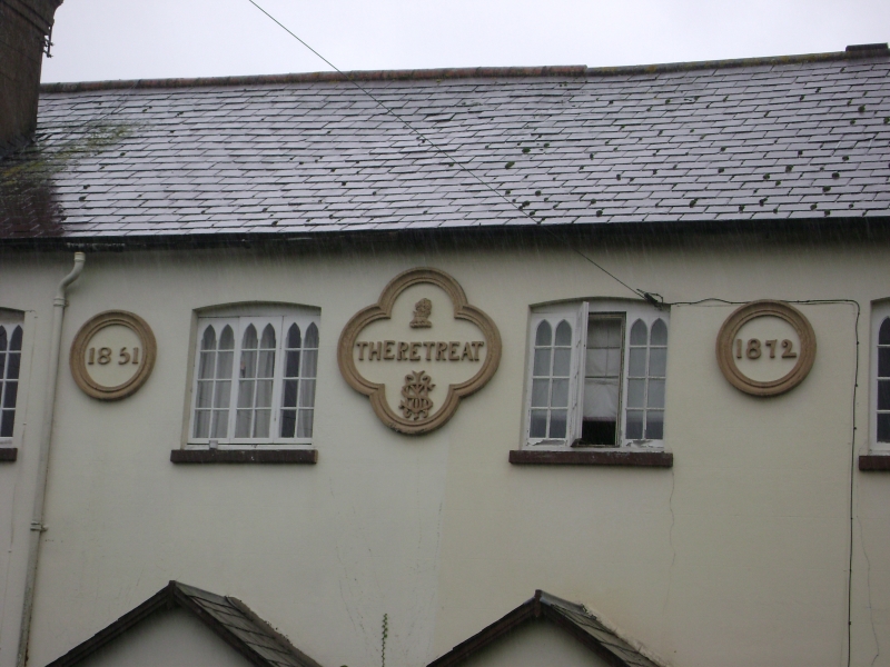
Dated 1851-1872. A range of Almshouses. Two storeys cement rendered. Slate
roof. Ten casement windows, some retaining pointed headed lights. Paired gabled
porches.
Listing NGR: TQ5326772097
External links are from the relevant listing authority and, where applicable, Wikidata. Wikidata IDs may be related buildings as well as this specific building. If you want to add or update a link, you will need to do so by editing the Wikidata entry.


Other nearby listed buildings
