Approximate Location Map
Large Map »
Latitude: 51.274 / 51°16'26"N
Longitude: 0.5221 / 0°31'19"E
OS Eastings: 576017
OS Northings: 155778
OS Grid: TQ760557
Mapcode National: GBR PR7.0TL
Mapcode Global: VHJMF.07CQ
Plus Code: 9F327GFC+HR
Entry Name: The Mitre Public House
Listing Date: 2 August 1974
Grade: II
Source: Historic England
Source ID: 1086297
English Heritage Legacy ID: 173415
ID on this website: 101086297
Location: Maidstone, Kent, ME14
County: Kent
District: Maidstone
Electoral Ward/Division: High Street
Parish: Non Civil Parish
Built-Up Area: Maidstone
Traditional County: Kent
Lieutenancy Area (Ceremonial County): Kent
Tagged with: Pub
MARKET BUILDINGS
1.
5278
(North-East Side)
The Mitre Public House
TQ 7655 NW 2/314
II GV
2.
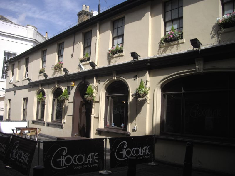
Mid C19. 2 storeys and basement stuccoed. Rounded corner to left side. Slate
roof. Stringcourse. 9 sashes 1 blank on 1st floor with some glazing bars
intact. The ground floor has a mid C19 bar front with 4 round-headed arches
with keystone, 1 cambered arch, and 2 round-headed doorcases.
Forms a group with Nos 8 & 9 High Street.
Listing NGR: TQ7601655782
External links are from the relevant listing authority and, where applicable, Wikidata. Wikidata IDs may be related buildings as well as this specific building. If you want to add or update a link, you will need to do so by editing the Wikidata entry.


Other nearby listed buildings
