Approximate Location Map
Large Map »
Latitude: 51.2721 / 51°16'19"N
Longitude: 0.5208 / 0°31'14"E
OS Eastings: 575932
OS Northings: 155568
OS Grid: TQ759555
Mapcode National: GBR PR7.0H9
Mapcode Global: VHJMD.Z954
Plus Code: 9F327GCC+R8
Entry Name: 22, Mill Street
Listing Date: 2 August 1974
Grade: II
Source: Historic England
Source ID: 1336231
English Heritage Legacy ID: 173430
ID on this website: 101336231
Location: Maidstone, Kent, ME15
County: Kent
District: Maidstone
Electoral Ward/Division: High Street
Parish: Non Civil Parish
Built-Up Area: Maidstone
Traditional County: Kent
Lieutenancy Area (Ceremonial County): Kent
Tagged with: Building
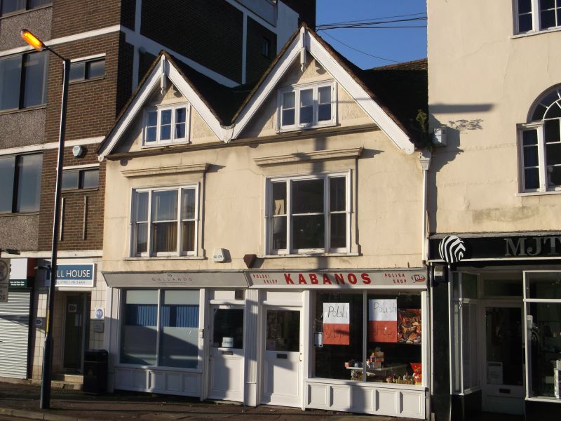
MILL STREET
1.
5278
(West Side)
No 22
TQ 7555 NE 1/322
II GV
2.
C17 restored. 2 storeys and attics stuccoed. 2 gables with plain wooden bargeboards
and pendants. Tiled roof. 2 triple casements to the dormers with modern metal
framed diamond panes. The 1st floor has 2 3-light mullions with cornice above
now obscured by a modern fascia. Modern shopfront.
Nos 16 to 22 (even) form a group.
Listing NGR: TQ7593055571
External links are from the relevant listing authority and, where applicable, Wikidata. Wikidata IDs may be related buildings as well as this specific building. If you want to add or update a link, you will need to do so by editing the Wikidata entry.


Other nearby listed buildings
