Approximate Location Map
Large Map »
Latitude: 51.2942 / 51°17'39"N
Longitude: 0.5688 / 0°34'7"E
OS Eastings: 579199
OS Northings: 158138
OS Grid: TQ791581
Mapcode National: GBR PQX.SRC
Mapcode Global: VHJM7.TQ2R
Plus Code: 9F327HV9+MG
Entry Name: Table Tomb Circa 12 Yards South of Church of St Martin of Tours
Listing Date: 20 July 1984
Grade: II
Source: Historic England
Source ID: 1336273
English Heritage Legacy ID: 173651
ID on this website: 101336273
Location: St Martin's Church, Detling, Maidstone, Kent, ME14
County: Kent
District: Maidstone
Civil Parish: Detling
Built-Up Area: Detling
Traditional County: Kent
Lieutenancy Area (Ceremonial County): Kent
Tagged with: Table tomb
TQ 75 NE DETLING THE STREET
(north side)
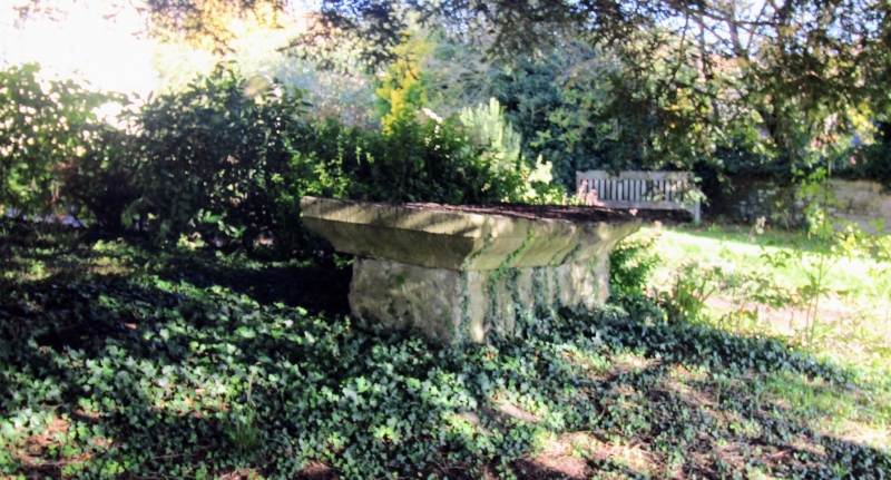
5/143 Table tomb circa 12
yards south of Church
of St. Martin of Tours
II
Table tomb. Early C18. Stone, with moulded plinth, corniced lid
and moulded side panels. Inscription illegible at time of resurvey.
Listing NGR: TQ7932458331
External links are from the relevant listing authority and, where applicable, Wikidata. Wikidata IDs may be related buildings as well as this specific building. If you want to add or update a link, you will need to do so by editing the Wikidata entry.


Other nearby listed buildings
