Approximate Location Map
Large Map »
Latitude: 51.2754 / 51°16'31"N
Longitude: 0.5786 / 0°34'43"E
OS Eastings: 579957
OS Northings: 156075
OS Grid: TQ799560
Mapcode National: GBR PR3.WNH
Mapcode Global: VHJMF.Z68M
Plus Code: 9F327HGH+5F
Entry Name: Hill House
Listing Date: 26 April 1968
Grade: II
Source: Historic England
Source ID: 1086171
English Heritage Legacy ID: 173724
ID on this website: 101086171
Location: Ware Street, Maidstone, Kent, ME14
County: Kent
District: Maidstone
Civil Parish: Bearsted
Built-Up Area: Maidstone
Traditional County: Kent
Lieutenancy Area (Ceremonial County): Kent
Tagged with: House
TQ 75 NE THURNHAM WARE STREET
(north side)
5/217 Hill House
26.4.68 II
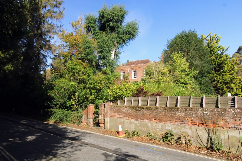
House. Mid C18. Red brick in Flemish bond with plain tile
roof. 2 storeys with rendered eaves band and plain brick-
coped parapet. Hipped roof. projecting end stacks. Regular
3-window front of recessed glazing-bar sashes with gauged
brick voussoirs. Recessed semi-circular-headed panelled door
to left with plain fanlight in architrave with gauged brick voussoirs.
Slightly earlier rear range.
Listing NGR: TQ7940956467
External links are from the relevant listing authority and, where applicable, Wikidata. Wikidata IDs may be related buildings as well as this specific building. If you want to add or update a link, you will need to do so by editing the Wikidata entry.


Other nearby listed buildings
