Approximate Location Map
Large Map »
Latitude: 51.2178 / 51°13'4"N
Longitude: 0.6754 / 0°40'31"E
OS Eastings: 586939
OS Northings: 149914
OS Grid: TQ869499
Mapcode National: GBR QTB.PKK
Mapcode Global: VHJMP.NNF9
Plus Code: 9F326M9G+45
Entry Name: Oast House Circa 15 Yards North of Elmstone Hole Farmhouse
Listing Date: 14 December 1984
Grade: II
Source: Historic England
Source ID: 1186150
English Heritage Legacy ID: 173880
ID on this website: 101186150
Location: Liverton Street, Maidstone, Kent, ME17
County: Kent
District: Maidstone
Civil Parish: Lenham
Traditional County: Kent
Lieutenancy Area (Ceremonial County): Kent
Tagged with: Drying house
LENHAM ELMSTONE HOLE ROAD
TQ 84 NE (north side)
Elmstone Hole
6/145
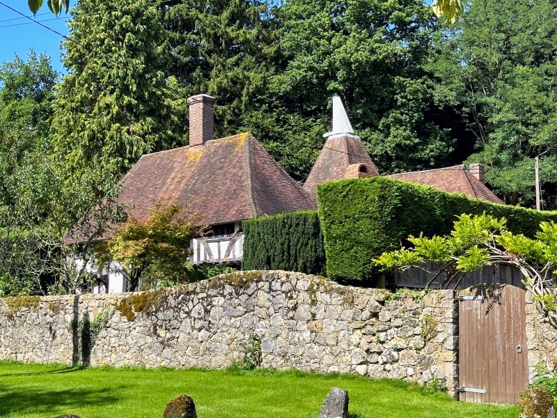
Oast House circa
15 yards north of
Elmstone Hole Farm-
house
GV
II
Oast house. C19. Square kiln with stowage to right. Kiln has
cowl, stowage has roof hipped to right. Plain tile roofs.
Interior not inspected. Listed for group value.
Listing NGR: TQ8693849898
External links are from the relevant listing authority and, where applicable, Wikidata. Wikidata IDs may be related buildings as well as this specific building. If you want to add or update a link, you will need to do so by editing the Wikidata entry.


Other nearby listed buildings
