Approximate Location Map
Large Map »
Latitude: 51.1925 / 51°11'33"N
Longitude: 0.5774 / 0°34'38"E
OS Eastings: 580191
OS Northings: 146859
OS Grid: TQ801468
Mapcode National: GBR PS8.2T2
Mapcode Global: VHJMT.Y9L4
Plus Code: 9F325HVG+2W
Entry Name: Lower Farm House
Listing Date: 18 December 1985
Grade: II
Source: Historic England
Source ID: 1067804
English Heritage Legacy ID: 174123
ID on this website: 101067804
Location: Devil's Den, Maidstone, Kent, ME17
County: Kent
District: Maidstone
Civil Parish: Sutton Valence
Traditional County: Kent
Lieutenancy Area (Ceremonial County): Kent
Tagged with: Farmhouse
SUTTON VALENCE BABYLON LANE
TQ 84 NW
(east side)
5/105 Lower Farm
House
GV II
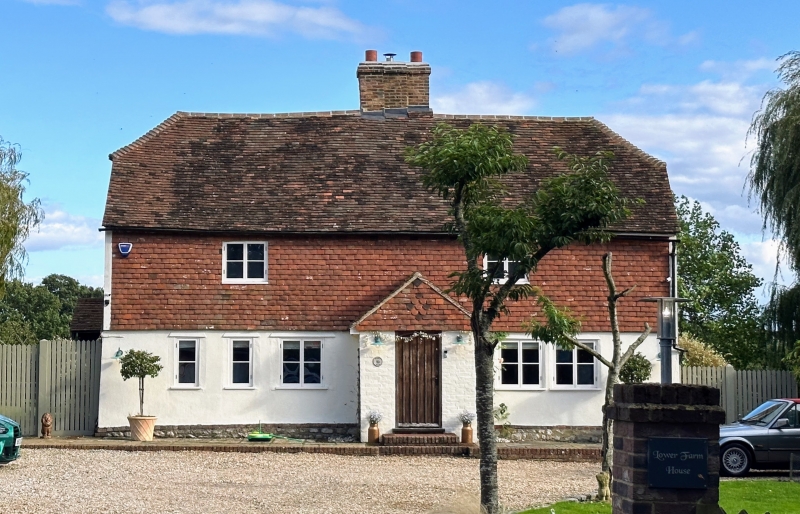
Farmhouse. Probably C17, with late C18 or early C19 facade.
Timber framed. Front elevation weatherboarded, gable ends
stone on ground floor, tile-hung above. Plain tile roof.
2 storeys on stone plinth. Half-hipped roof. Multiple central
brick ridge stack. Irregular fenestration of two 2-light
casements. Central ribbed door in painted brick porch.
Interior not inspected.
Listing NGR: TQ7992845529
External links are from the relevant listing authority and, where applicable, Wikidata. Wikidata IDs may be related buildings as well as this specific building. If you want to add or update a link, you will need to do so by editing the Wikidata entry.


Other nearby listed buildings
