Approximate Location Map
Large Map »
Latitude: 51.1676 / 51°10'3"N
Longitude: 0.619 / 0°37'8"E
OS Eastings: 583198
OS Northings: 144193
OS Grid: TQ831441
Mapcode National: GBR QTV.MBP
Mapcode Global: VHJMV.PX38
Plus Code: 9F325J99+3H
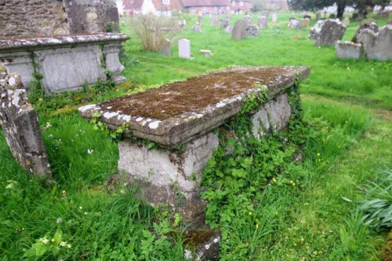
Entry Name: Table Tomb About 5 Metres South of South Chapel of Church of St Peter and St Paul
Listing Date: 21 October 1986
Grade: II
Source: Historic England
Source ID: 1060868
English Heritage Legacy ID: 174257
ID on this website: 101060868
Location: St Peter and St Paul's Church, Headcorn, Maidstone, Kent, TN27
County: Kent
District: Maidstone
Civil Parish: Headcorn
Built-Up Area: Headcorn
Traditional County: Kent
Lieutenancy Area (Ceremonial County): Kent
Tagged with: Table tomb
HEADCORN
TQ 8344
10/31 Table Tomb about 5
metres south of
south chapel of
Church of St. Peter
and St. Paul
GV II
Table tomb. Early-to-mid C18. Stone, on stone base, with moulded plinth,
corniced lid and wave-moulded side panels. Inscription largely illegible at
time of re-survey. Date of death 1733?
Listing NGR: TQ8319844193
External links are from the relevant listing authority and, where applicable, Wikidata. Wikidata IDs may be related buildings as well as this specific building. If you want to add or update a link, you will need to do so by editing the Wikidata entry.


Other nearby listed buildings
