Approximate Location Map
Large Map »
Latitude: 51.2304 / 51°13'49"N
Longitude: 0.5323 / 0°31'56"E
OS Eastings: 576896
OS Northings: 150962
OS Grid: TQ768509
Mapcode National: GBR PRM.WYS
Mapcode Global: VHJMM.5BRL
Plus Code: 9F326GJJ+5W
Entry Name: Mounting Block Immediately West of No 63
Listing Date: 11 August 1988
Grade: II
Source: Historic England
Source ID: 1261039
English Heritage Legacy ID: 174650
ID on this website: 101261039
Location: Boughton Monchelsea, Maidstone, Kent, ME17
County: Kent
District: Maidstone
Civil Parish: Boughton Monchelsea
Built-Up Area: Maidstone
Traditional County: Kent
Lieutenancy Area (Ceremonial County): Kent
Tagged with: Mounting block
The following building shall be added to the list:-
BOUGHTON MONCHELSEA CHURCH STREET
TQ 75 SE
1/180 Mounting Block
immediately west
of No 63
- II
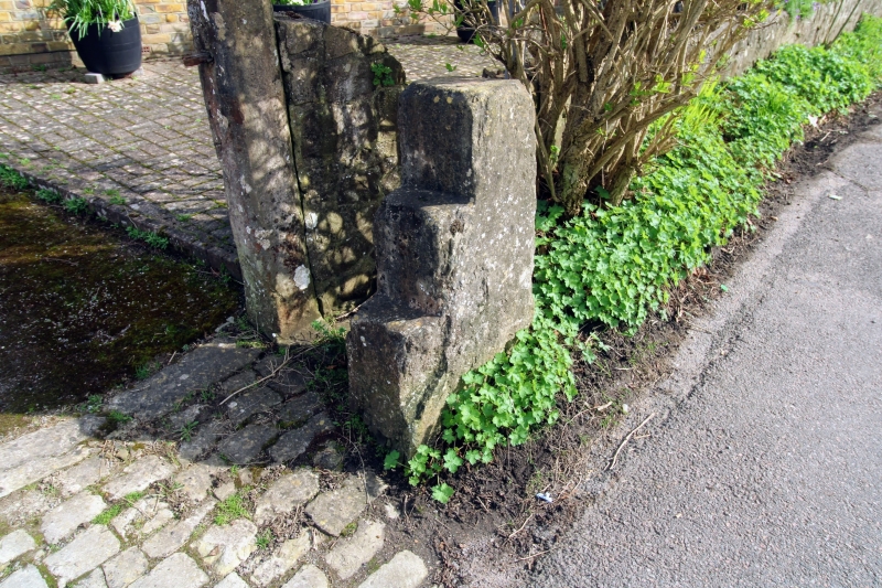
Mounting block. Probably C19 or earlier. Stone monolith. In the form of a
slab out of which 3 steps have been cut on one side. On the opposite side there
is a metal ring.
Listing NGR: TQ7689650961
External links are from the relevant listing authority and, where applicable, Wikidata. Wikidata IDs may be related buildings as well as this specific building. If you want to add or update a link, you will need to do so by editing the Wikidata entry.


Other nearby listed buildings
