Approximate Location Map
Large Map »
Latitude: 51.2472 / 51°14'50"N
Longitude: 0.4533 / 0°27'11"E
OS Eastings: 571320
OS Northings: 152645
OS Grid: TQ713526
Mapcode National: GBR PRB.MG1
Mapcode Global: VHJMC.TX07
Plus Code: 9F326FW3+V8
Entry Name: Wall Enclosing Garden of West Farleigh Hall
Listing Date: 14 October 1987
Grade: II
Source: Historic England
Source ID: 1115805
English Heritage Legacy ID: 174825
ID on this website: 101115805
Location: West Farleigh, Maidstone, Kent, ME15
County: Kent
District: Maidstone
Civil Parish: West Farleigh
Traditional County: Kent
Lieutenancy Area (Ceremonial County): Kent
Church of England Parish: West Farleigh All Saints
Church of England Diocese: Rochester
Tagged with: Wall
WEST FARLEIGH LOWER ROAD
TQ 75 SW
(East side)
2/22 Wall enclosing
garden of West
Farleigh Hall
GV II
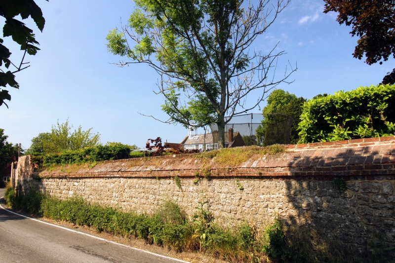
Garden wall. Probably early c18. Red and grey brick on a coursed
ragstone base. Surrounds the garden of West Farleigh Hall on virtually
every side. North end of west boundary wall red and grey brick in a
Flemish-type bond, on galleted ragstone base, about 9' high, and
extending about 85' from north-west corner to first gatepier; also
returns from north-west corner to form north boundary of garden. Gateway
to north of centre of west wall has rectangular piers (to which wall is
ramped down), with moulded cornice and ball finials. Wooden gates,
ramped up to piers at ends. Central section of west wall about 4' high
built of coursed ragstone, with red and grey brick parapet, extending about
90' between gateways, opposite house. Gateway to south of centre of west
wall similar to north-central gateway. Beyond it, stone wall continues
about 60' south-south-east to gateway to former stable yard, which is
similar to the other gateways. Thereafter the wall increases in height,
with chequered red and grey brick above a galleted stone base, continuing
about 225' south-east bordering Ewell Lane, then reducing to height of
stone base for a further 55'. (Country Life 21st September 1967).
Listing NGR: TQ7132052644
External links are from the relevant listing authority and, where applicable, Wikidata. Wikidata IDs may be related buildings as well as this specific building. If you want to add or update a link, you will need to do so by editing the Wikidata entry.


Other nearby listed buildings
