Approximate Location Map
Large Map »
Latitude: 51.0717 / 51°4'18"N
Longitude: 1.0824 / 1°4'56"E
OS Eastings: 616034
OS Northings: 134785
OS Grid: TR160347
Mapcode National: GBR V0L.QH4
Mapcode Global: FRA F649.5GQ
Plus Code: 9F3333CJ+MW
Entry Name: 5 and 7, Bartholomew Street
Listing Date: 21 December 1973
Grade: II
Source: Historic England
Source ID: 1068969
English Heritage Legacy ID: 175084
ID on this website: 101068969
Location: Hythe, Folkestone and Hythe, Kent, CT21
County: Kent
District: Folkestone and Hythe
Civil Parish: Hythe
Built-Up Area: Hythe
Traditional County: Kent
Lieutenancy Area (Ceremonial County): Kent
Tagged with: Building
1.
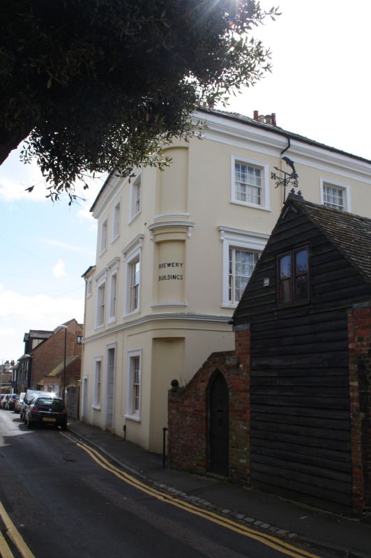
1253 BARTHOLOMEW STREET
(South Side)
Nos 5 and 7
TR 1634 NE 2/85
II
2.
Circa 1840. 3 storeys rendered. Wide moulded cornice. 3 sashes with Italianate
architraves and console brackets. The ground floor has 2 doorcases set in moulded
architraves with panelled doors. Rounded corner with 3 sashes on the side elevation.
Listing NGR: TR1603734785
External links are from the relevant listing authority and, where applicable, Wikidata. Wikidata IDs may be related buildings as well as this specific building. If you want to add or update a link, you will need to do so by editing the Wikidata entry.


Other nearby listed buildings
