Approximate Location Map
Large Map »
Latitude: 51.0723 / 51°4'20"N
Longitude: 1.0834 / 1°5'0"E
OS Eastings: 616107
OS Northings: 134851
OS Grid: TR161348
Mapcode National: GBR V0L.QQM
Mapcode Global: FRA F649.5WM
Plus Code: 9F3333CM+W9
Entry Name: Cantle Cottage and Wall Adjoining West and South Sides
Listing Date: 21 December 1973
Last Amended: 22 November 1974
Grade: II
Source: Historic England
Source ID: 1299551
English Heritage Legacy ID: 175093
ID on this website: 101299551
Location: Hythe, Folkestone and Hythe, Kent, CT21
County: Kent
District: Folkestone and Hythe
Civil Parish: Hythe
Built-Up Area: Hythe
Traditional County: Kent
Lieutenancy Area (Ceremonial County): Kent
Tagged with: Cottage
1. CHURCH HILL
1253 (North East Side)
Church Hill Cottage and
Wall adjoining West and
South sides
TR 1634 NW 2/45
II
2.
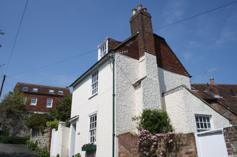
Early C19. 2 storeys and attics brown brick. Half-hipped tiled roof and modillion
eaves cornice. 1 dormer and window with glazing bars intact. Doorcase in
frame with projecting cornice over, rectangular fanlight and 6 panelled door.
Adjoining is a mediaeval masonry wall, part of a network of such walls, forming
the boundary of gardens and plots of land in the area around the Parish Church
of St Leonard.
Church Hill Cottage and Wall adjoining West and South Sides shall be amended to read
No 16 (Cantle Cottage) and Wall adjoining West and South Sides
------------------------------------------
1.
1253 CHURCH HILL
(North East Side)
Church Hill Cottage and
Wall adjoining West and
South sides
TR 1634 NW 2/45
II
2.
Early C19. 2 storeys and attics brown brick. Half-hipped tiled roof and modillion
eaves cornice. 1 dormer and 1 window with glazing bars intact. Doorcase in
frame with projecting cornice over, rectangular fanlight and 6 panelled door.
Adjoining is a mediaeval masonry wall, part of a network of such walls, forming
the boundary of gardens and plots of land in the area around the Parish Church
of St Leonard.
Listing NGR: TR1610734851
External links are from the relevant listing authority and, where applicable, Wikidata. Wikidata IDs may be related buildings as well as this specific building. If you want to add or update a link, you will need to do so by editing the Wikidata entry.


Other nearby listed buildings
