Approximate Location Map
Large Map »
Latitude: 51.0706 / 51°4'14"N
Longitude: 1.0786 / 1°4'42"E
OS Eastings: 615776
OS Northings: 134655
OS Grid: TR157346
Mapcode National: GBR V0L.X2R
Mapcode Global: FRA F649.40Y
Plus Code: 9F3333CH+7C
Entry Name: Dukes Head Inn
Listing Date: 3 January 1950
Grade: II
Source: Historic England
Source ID: 1185735
English Heritage Legacy ID: 175098
Also known as: Dukes Head
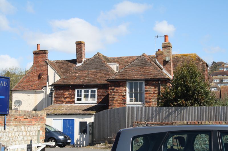
The Dukes Head, Hythe
ID on this website: 101185735
1.
1253 DYMCHURCH ROAD
(South Side)
No 9
(The Duke's Head Inn)
TR 1534 NE 1/72 3.1.50
II
2.
An early C19 L-shaped building. 2 storeys and attics stuccoed. Tiled roof
has 2 dormers Long and short quoins. 4 sashes in stuccoed surrounds with
glazing bars intact. 2 rusticated doorways. The left side elevation is tile-hung.
Listing NGR: TR1577734653
External links are from the relevant listing authority and, where applicable, Wikidata. Wikidata IDs may be related buildings as well as this specific building. If you want to add or update a link, you will need to do so by editing the Wikidata entry.


Other nearby listed buildings
