Approximate Location Map
Large Map »
Latitude: 51.0716 / 51°4'17"N
Longitude: 1.0831 / 1°4'59"E
OS Eastings: 616088
OS Northings: 134769
OS Grid: TR160347
Mapcode National: GBR V0L.QNP
Mapcode Global: FRA F649.5SN
Plus Code: 9F3333CM+J6
Entry Name: 53 and 53A, High Street
Listing Date: 21 December 1973
Grade: II
Source: Historic England
Source ID: 1185756
English Heritage Legacy ID: 175105
ID on this website: 101185756
Location: Hythe, Folkestone and Hythe, Kent, CT21
County: Kent
District: Folkestone and Hythe
Civil Parish: Hythe
Built-Up Area: Hythe
Traditional County: Kent
Lieutenancy Area (Ceremonial County): Kent
Tagged with: Building
1.
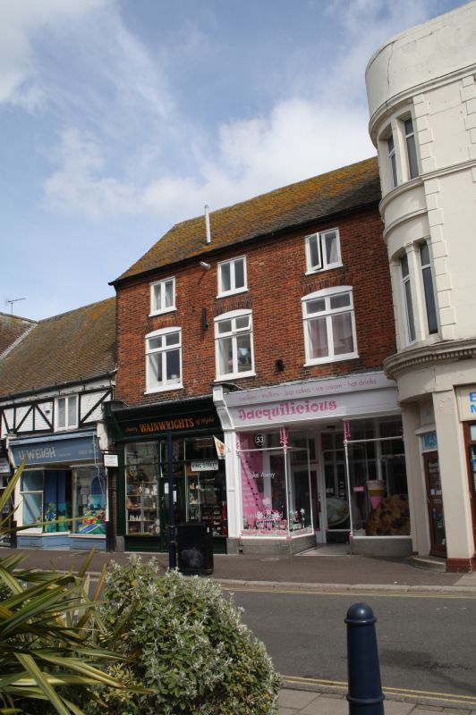
1253 HIGH STREET
(North Side)
Nos 53 and 53A
TR 1634 NW 2/4
II
2.
Built as one house. C18. 3 storeys red brick. Tiled roof and eaves cornice.
3 modern windows and shop fronts. Part of the side elevation is tile-hung.
Listing NGR: TR1608834773
External links are from the relevant listing authority and, where applicable, Wikidata. Wikidata IDs may be related buildings as well as this specific building. If you want to add or update a link, you will need to do so by editing the Wikidata entry.


Other nearby listed buildings
