Approximate Location Map
Large Map »
Latitude: 51.0716 / 51°4'17"N
Longitude: 1.0843 / 1°5'3"E
OS Eastings: 616173
OS Northings: 134780
OS Grid: TR161347
Mapcode National: GBR V0L.QYF
Mapcode Global: FRA F659.085
Plus Code: 9F3333CM+JP
Entry Name: The White Hart Inn
Listing Date: 3 January 1950
Grade: II
Source: Historic England
Source ID: 1185836
English Heritage Legacy ID: 175108
Also known as: White Hart
The White Hart, Hythe
ID on this website: 101185836
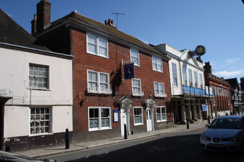
1.
1253 HIGH STREET
(North Side)
No 71
(The White Hart Inn)
TR 1634 NW 2/7 3.1.50.
II GV
2.
C18. 3 storeys red brick. Hipped tiled roof. Eaves cornice. 3 sashes, 2
of them double sashes with glazing bars missing. 2 doorcases with pediments
over supported on brackets, the west one containing an 8-panel moulded door.
Nos 67 to 79 (odd) and Town Hall form a group.
Listing NGR: TR1616734788
External links are from the relevant listing authority and, where applicable, Wikidata. Wikidata IDs may be related buildings as well as this specific building. If you want to add or update a link, you will need to do so by editing the Wikidata entry.


Other nearby listed buildings
