Approximate Location Map
Large Map »
Latitude: 51.0723 / 51°4'20"N
Longitude: 1.0828 / 1°4'58"E
OS Eastings: 616065
OS Northings: 134851
OS Grid: TR160348
Mapcode National: GBR V0L.QL7
Mapcode Global: FRA F649.5P1
Plus Code: 9F3333CM+W4
Entry Name: Chimneys
Listing Date: 21 December 1973
Grade: II
Source: Historic England
Source ID: 1068950
English Heritage Legacy ID: 175137
ID on this website: 101068950
Location: Hythe, Folkestone and Hythe, Kent, CT21
County: Kent
District: Folkestone and Hythe
Civil Parish: Hythe
Built-Up Area: Hythe
Traditional County: Kent
Lieutenancy Area (Ceremonial County): Kent
Tagged with: Building
1.
1253 HILLSIDE STREET
(South Side)
No 7 (Chimneys)
Nos 9 and 11
TR 1634 NW 2/40
II GV
2.
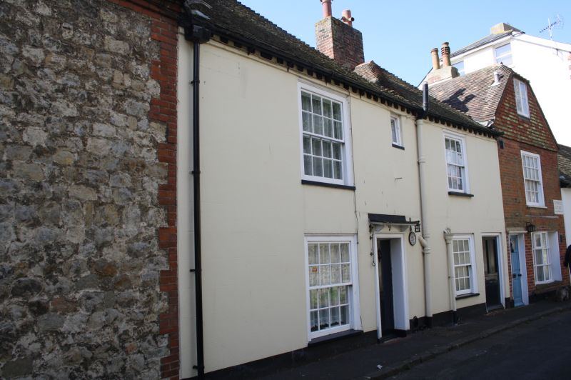
3 small C18 houses. Nos 7 and 11 have 2 storeys and 2 windows each and No 9
has 3 storeys and 1 window. Nos 7 and 11 are cemented. No 9 is of painted
brick with a half-hipped tiled gable. Tiled roofs. No 7 has a modillion eaves
cornice, Glazing bars intact. Nos 7 and 11 have doorcases with flat hoods
over.
Nos 7 to 11 (odd) form a group with No 17 Church Hill.
Listing NGR: TR1605934849
External links are from the relevant listing authority and, where applicable, Wikidata. Wikidata IDs may be related buildings as well as this specific building. If you want to add or update a link, you will need to do so by editing the Wikidata entry.


Other nearby listed buildings
