Approximate Location Map
Large Map »
Latitude: 51.0735 / 51°4'24"N
Longitude: 1.0827 / 1°4'57"E
OS Eastings: 616051
OS Northings: 134980
OS Grid: TR160349
Mapcode National: GBR V0L.QJQ
Mapcode Global: FRA F648.ZKQ
Plus Code: 9F3333FM+93
Entry Name: 80, North Road
Listing Date: 21 December 1973
Grade: II
Source: Historic England
Source ID: 1344104
English Heritage Legacy ID: 175158
ID on this website: 101344104
Location: Hythe, Folkestone and Hythe, Kent, CT21
County: Kent
District: Folkestone and Hythe
Civil Parish: Hythe
Built-Up Area: Hythe
Traditional County: Kent
Lieutenancy Area (Ceremonial County): Kent
Tagged with: Building
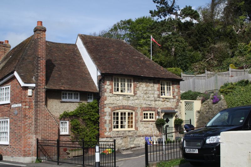
1.
1253 NORTH ROAD
No 80
TR 1634 NW 2/49
II GV
2.
A timber-framed building refronted. 2 storeys ashlar with red brick quoins
and window dressings. Tiled roof. 2 casement windows with cambered heads on
ground floor. Simple doorcase with flat weather hood and brackets.
Nos 80 and 82 form a group.
Listing NGR: TR1604934978
External links are from the relevant listing authority and, where applicable, Wikidata. Wikidata IDs may be related buildings as well as this specific building. If you want to add or update a link, you will need to do so by editing the Wikidata entry.


Other nearby listed buildings
