Approximate Location Map
Large Map »
Latitude: 51.0634 / 51°3'48"N
Longitude: 1.0742 / 1°4'27"E
OS Eastings: 615500
OS Northings: 133837
OS Grid: TR155338
Mapcode National: GBR V0S.8DF
Mapcode Global: FRA F649.N9M
Plus Code: 9F33337F+9M
Entry Name: Martello Tower (No 14)
Listing Date: 21 December 1973
Grade: II
Source: Historic England
Source ID: 1319907
English Heritage Legacy ID: 175167
ID on this website: 101319907
Location: Folkestone and Hythe, Kent, CT21
County: Kent
District: Folkestone and Hythe
Civil Parish: Hythe
Built-Up Area: Hythe
Traditional County: Kent
Lieutenancy Area (Ceremonial County): Kent
1.
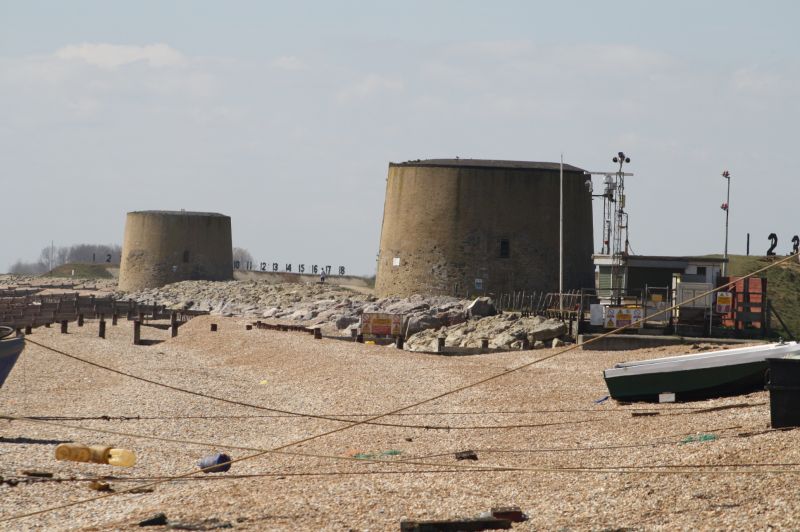
1253 THE RANGES
Martello Tower
(No 14)
TR 13 SE 5/78A
II
2.
Erected in 1806 as part of the coastal defence-system against an invasion from
Napoleonic France. Built of brick with a coating of cement on the outside.
The walls are 5½ to 6 ft thick. It is built around a centre column 5 ft thick
and consists of 2 storeys with a flat roof as a gun platform.
Listing NGR: TR1550033837
External links are from the relevant listing authority and, where applicable, Wikidata. Wikidata IDs may be related buildings as well as this specific building. If you want to add or update a link, you will need to do so by editing the Wikidata entry.


Other nearby listed buildings
