Approximate Location Map
Large Map »
Latitude: 51.079 / 51°4'44"N
Longitude: 1.1828 / 1°10'58"E
OS Eastings: 623036
OS Northings: 135899
OS Grid: TR230358
Mapcode National: GBR W21.CVT
Mapcode Global: FRA F6C8.GND
Plus Code: 9F3335HM+J4
Entry Name: 12, the Bayle
Listing Date: 11 March 1975
Grade: II
Source: Historic England
Source ID: 1068923
English Heritage Legacy ID: 175265
ID on this website: 101068923
Location: Folkestone, Folkestone and Hythe, Kent, CT20
County: Kent
District: Folkestone and Hythe
Civil Parish: Folkestone
Built-Up Area: Folkestone
Traditional County: Kent
Lieutenancy Area (Ceremonial County): Kent
Tagged with: Building
1.
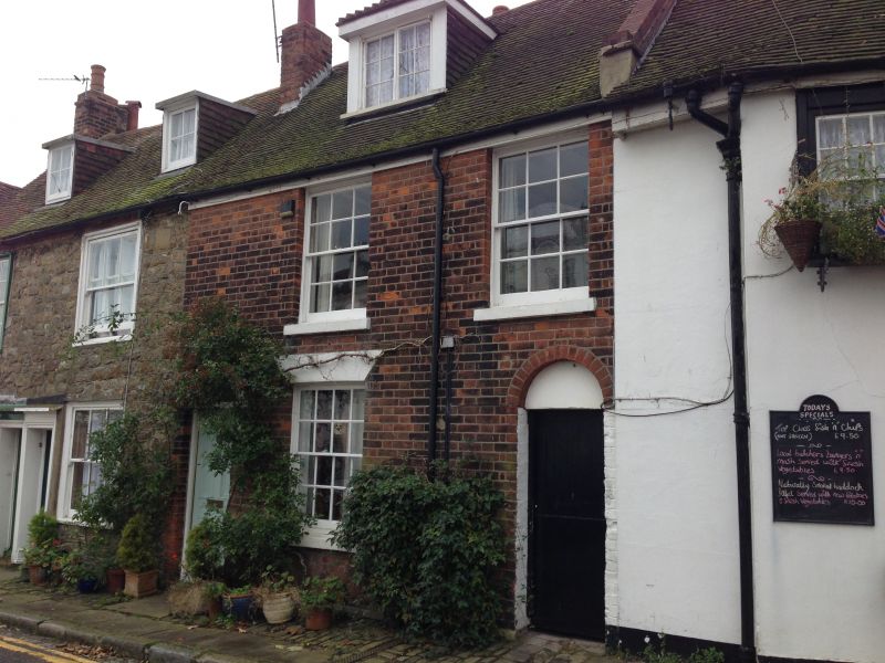
5281 THE BAYLE
(South Side)
FOLKESTONE
No 12
TR 2335 NW 2/48
II GV
2.
Circa 1840. 2 storeys and attics red brick. Tiled roof with 1 dormer. 2 sashes
with glazing bars intact and round-headed doorcase.
Priory House and Nos 4 to 18 (even) form a group.
Listing NGR: TR2303635899
External links are from the relevant listing authority and, where applicable, Wikidata. Wikidata IDs may be related buildings as well as this specific building. If you want to add or update a link, you will need to do so by editing the Wikidata entry.


Other nearby listed buildings
