Approximate Location Map
Large Map »
Latitude: 51.0774 / 51°4'38"N
Longitude: 1.1741 / 1°10'26"E
OS Eastings: 622431
OS Northings: 135686
OS Grid: TR224356
Mapcode National: GBR W21.9NT
Mapcode Global: FRA F6B8.R6W
Plus Code: 9F3335GF+WJ
Entry Name: 151, Sandgate Road
Listing Date: 11 March 1975
Grade: II
Source: Historic England
Source ID: 1204285
English Heritage Legacy ID: 175441
ID on this website: 101204285
Location: Folkestone, Folkestone and Hythe, Kent, CT20
County: Kent
District: Folkestone and Hythe
Civil Parish: Folkestone
Built-Up Area: Folkestone
Traditional County: Kent
Lieutenancy Area (Ceremonial County): Kent
Tagged with: Building
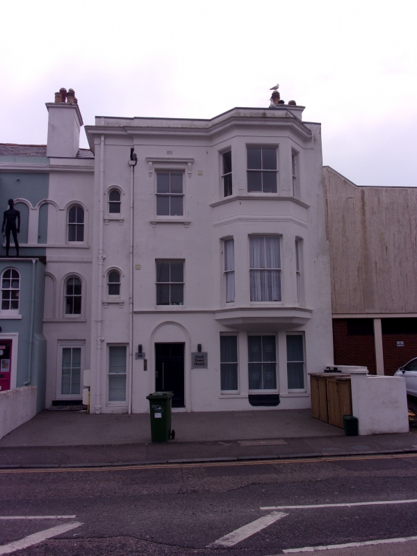
1.
5281 SANDGATE ROAD
FOLKESTONE
No 151
TR 2255 NW 5/256
II GV
2.
A mid Cl9 house, originally part of a pair not quite uniform the other part
demolished. 3 storeys stuccoed. Slate roof. Parapet and dropped eaves cornice.
Centre , 3-light canted hay, 1 sash and 2 round-headed sashes. Modern shop front
to ground floor.
Nos 149 and l5l form a group.
Listing NGR: TR2243135686
External links are from the relevant listing authority and, where applicable, Wikidata. Wikidata IDs may be related buildings as well as this specific building. If you want to add or update a link, you will need to do so by editing the Wikidata entry.


Other nearby listed buildings
