Approximate Location Map
Large Map »
Latitude: 51.3502 / 51°21'0"N
Longitude: 0.7322 / 0°43'55"E
OS Eastings: 590356
OS Northings: 164779
OS Grid: TQ903647
Mapcode National: GBR QRV.CY1
Mapcode Global: VHKJL.MBY8
Plus Code: 9F329P2J+3V
Entry Name: 117, High Street
Listing Date: 10 September 1951
Grade: II
Source: Historic England
Source ID: 1061053
English Heritage Legacy ID: 175746
ID on this website: 101061053
Location: Milton Regis, Swale, Kent, ME10
County: Kent
District: Swale
Electoral Ward/Division: Milton Regis
Parish: Non Civil Parish
Built-Up Area: Sittingbourne
Traditional County: Kent
Lieutenancy Area (Ceremonial County): Kent
Tagged with: Building
1.
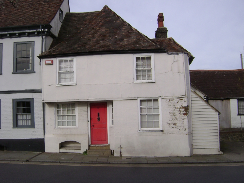
5282 HIGH STREET
(West Side)
MILTON REGIS
No 117
TQ 9064 NW 1/108 10.9.51.
II GV
2.
A timber-framed house with the left half of its 1st floor Jettied, the right half
now underbuilt. Ground floor painted brick, above plastered. Steeply- pitched
hipped tiled roof. 2 sash windows with glazing bars intact.
Nos 113 to 117 (odd) form a group.
Listing NGR: TQ9035664779
External links are from the relevant listing authority and, where applicable, Wikidata. Wikidata IDs may be related buildings as well as this specific building. If you want to add or update a link, you will need to do so by editing the Wikidata entry.


Other nearby listed buildings
