Approximate Location Map
Large Map »
Latitude: 51.3478 / 51°20'52"N
Longitude: 0.7325 / 0°43'56"E
OS Eastings: 590386
OS Northings: 164512
OS Grid: TQ903645
Mapcode National: GBR RT6.D09
Mapcode Global: VHKJL.ND34
Plus Code: 9F328PXJ+4X
Entry Name: 44 and 46, High Street
Listing Date: 10 September 1951
Grade: II
Source: Historic England
Source ID: 1038931
English Heritage Legacy ID: 175748
ID on this website: 101038931
Location: Milton Regis, Swale, Kent, ME10
County: Kent
District: Swale
Electoral Ward/Division: Milton Regis
Parish: Non Civil Parish
Built-Up Area: Sittingbourne
Traditional County: Kent
Lieutenancy Area (Ceremonial County): Kent
Tagged with: Building
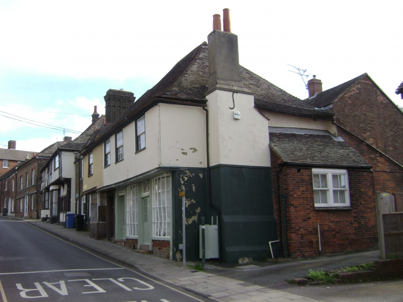
1.
5282 HIGH STREET
(East Side)
MILTON REGIS
Nos 44 and 46
TQ 9064 NW 1/69 10.9.51
II
2.
One building, timber-framed, refronted in C18 but retaining the overhang of the
1st floor on a bressumer. 2 storeys stuccoed. Tiled roof. 4 sashes with glazing
bars intact including a bay on the ground floor and 2 curved shop windows. Doorcase
in a fluted architrave surround with 6 panel door.
Listing NGR: TQ9038664512
External links are from the relevant listing authority and, where applicable, Wikidata. Wikidata IDs may be related buildings as well as this specific building. If you want to add or update a link, you will need to do so by editing the Wikidata entry.


Other nearby listed buildings
