Approximate Location Map
Large Map »
Latitude: 51.3172 / 51°19'2"N
Longitude: 0.8922 / 0°53'31"E
OS Eastings: 601637
OS Northings: 161540
OS Grid: TR016615
Mapcode National: GBR SW3.BCW
Mapcode Global: VHKJW.F501
Plus Code: 9F328V8R+VV
Entry Name: 19, Court Street
Listing Date: 29 July 1950
Grade: II
Source: Historic England
Source ID: 1116354
English Heritage Legacy ID: 175893
ID on this website: 101116354
Location: Faversham, Swale, Kent, ME13
County: Kent
District: Swale
Civil Parish: Faversham
Built-Up Area: Faversham
Traditional County: Kent
Lieutenancy Area (Ceremonial County): Kent
Tagged with: Building
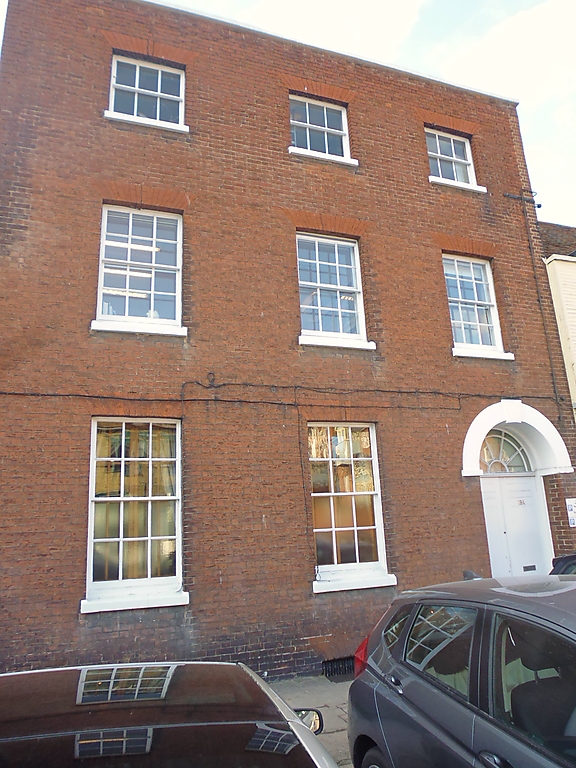
COURT STREET
1.
1103 (West Side)
-----------
No 19
TR 0161 NE 1/25 29.7.50.
II GV
2.
Early C19. 3 storeys. 3 windows. Red brick. Parapet. Glazing bars
intact. High and wide round-headed doorway with semi-circular fanlight,
keystone over and 6-panel double doors.
Nos 17 to 25 (consec) form a group.
Listing NGR: TR0163461542
External links are from the relevant listing authority and, where applicable, Wikidata. Wikidata IDs may be related buildings as well as this specific building. If you want to add or update a link, you will need to do so by editing the Wikidata entry.


Other nearby listed buildings
