Approximate Location Map
Large Map »
Latitude: 51.3166 / 51°18'59"N
Longitude: 0.892 / 0°53'31"E
OS Eastings: 601627
OS Northings: 161465
OS Grid: TR016614
Mapcode National: GBR SW3.J9X
Mapcode Global: VHKJW.D5XK
Plus Code: 9F328V8R+JQ
Entry Name: Stone Setts in Pavement Within Curtilage of Nos 39, 39A and 40 to West Side
Listing Date: 3 August 1972
Grade: II
Source: Historic England
Source ID: 1069491
English Heritage Legacy ID: 175903
ID on this website: 101069491
Location: Faversham, Swale, Kent, ME13
County: Kent
District: Swale
Civil Parish: Faversham
Built-Up Area: Faversham
Traditional County: Kent
Lieutenancy Area (Ceremonial County): Kent
Tagged with: Building
COURT STREET
1.
ll03 (East Side)
-----------
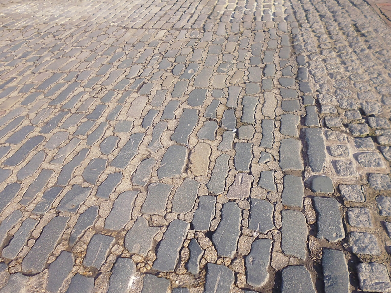
Stone setts in pavement
within curtilage of Nos 39,
39A and 40 to West side
TR 0161 SE 3/32A
II
2.
Stone setts in pavement forming an irregular shape, about 17 x 8 feet
to South of doorway in No 40; area of stone setts to North of doorway
in No 40 contiguous with setts before Nos 39 and 39A.
Listing NGR: TR0162361462
External links are from the relevant listing authority and, where applicable, Wikidata. Wikidata IDs may be related buildings as well as this specific building. If you want to add or update a link, you will need to do so by editing the Wikidata entry.


Other nearby listed buildings
