Approximate Location Map
Large Map »
Latitude: 51.31 / 51°18'35"N
Longitude: 0.8902 / 0°53'24"E
OS Eastings: 601532
OS Northings: 160729
OS Grid: TR015607
Mapcode National: GBR SW3.XHN
Mapcode Global: VHKJW.CBZM
Plus Code: 9F328V5R+X3
Entry Name: Grove House
Listing Date: 3 August 1972
Grade: II
Source: Historic England
Source ID: 1069436
English Heritage Legacy ID: 175971
Also known as: 16 Preston Grove
ID on this website: 101069436
Location: Preston, Swale, Kent, ME13
County: Kent
District: Swale
Civil Parish: Faversham
Built-Up Area: Faversham
Traditional County: Kent
Lieutenancy Area (Ceremonial County): Kent
Tagged with: House
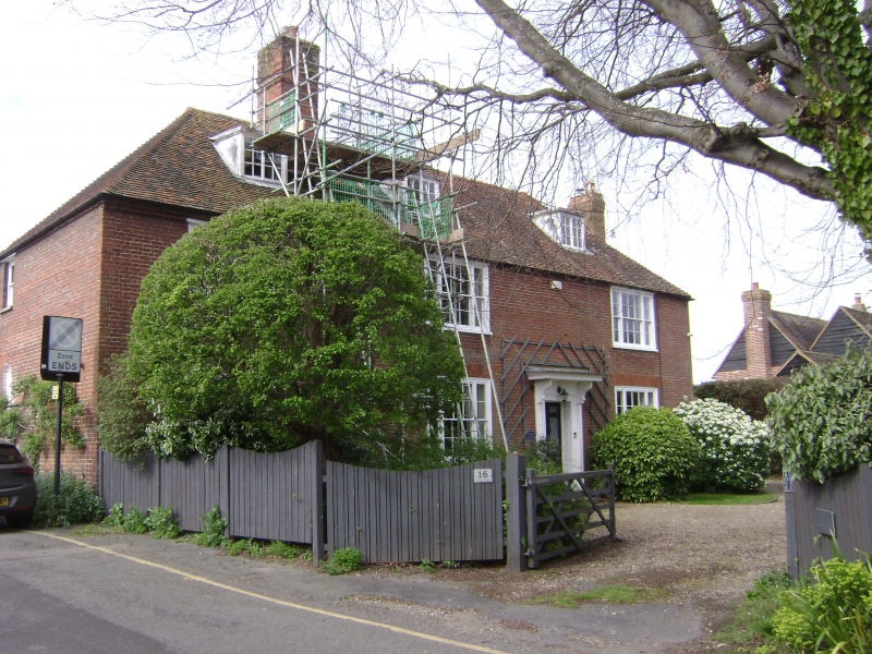
PRESTON GROVE
1. -------------
1103
No 16
(Grove House)
TR 0160 12/141
II
2.
Early C19 and earlier. 2 storeys and attic. 3 windows. 3 dormers.
Red brick. Eaves cornice. Glazing bars intact. Doorway with
pilasters and projecting cornice. On ground floor to left hand
original casement window with leaded glazing.
Listing NGR: TR0150660655
External links are from the relevant listing authority and, where applicable, Wikidata. Wikidata IDs may be related buildings as well as this specific building. If you want to add or update a link, you will need to do so by editing the Wikidata entry.


Other nearby listed buildings
