Approximate Location Map
Large Map »
Latitude: 51.3181 / 51°19'4"N
Longitude: 0.892 / 0°53'31"E
OS Eastings: 601624
OS Northings: 161632
OS Grid: TR016616
Mapcode National: GBR SW3.BBH
Mapcode Global: VHKJW.D4YD
Plus Code: 9F328V9R+6R
Entry Name: The Coal Exchange Inn
Listing Date: 3 August 1972
Grade: II
Source: Historic England
Source ID: 1115606
English Heritage Legacy ID: 176006
ID on this website: 101115606
Location: Faversham, Swale, Kent, ME13
County: Kent
District: Swale
Civil Parish: Faversham
Built-Up Area: Faversham
Traditional County: Kent
Lieutenancy Area (Ceremonial County): Kent
Tagged with: Inn
QUAY LANE
---------
1.
1103
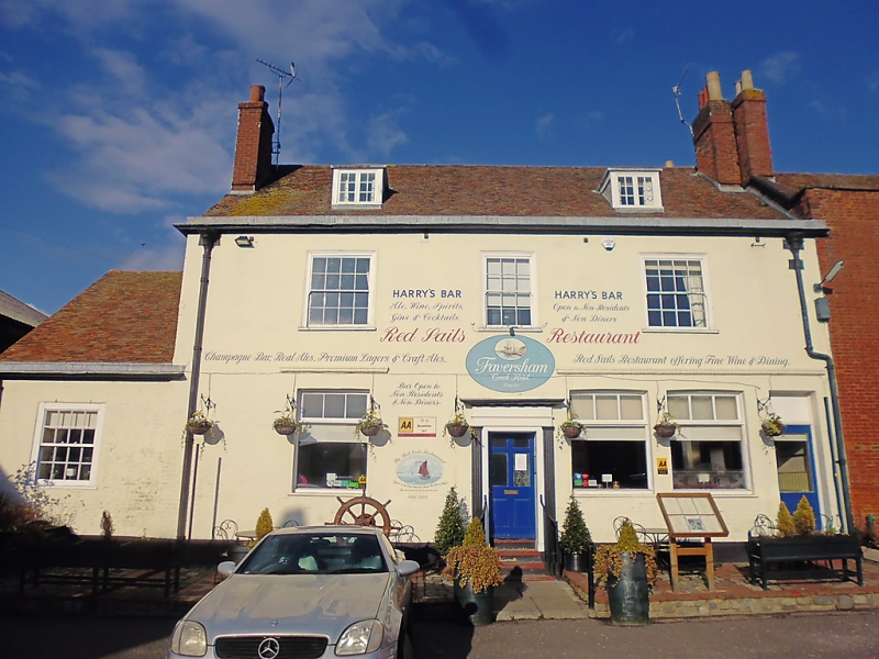
The Coal Exchange Inn
TR 0161 NE 1/97
II GV
2.
Cl8. 2 storeys and attic. 3 windows. 2 dormers. Painted brik.
Cornice and blocking oource. Glaz ne bars intact on 1st floor.
Modern windows below. Doorway with fluted pilasters, projecting
cornice and 6-panel door.
The Coal Echange Inn forms a group with No 1 Belvedere Road.
Listing NGR: TR0162461632
External links are from the relevant listing authority and, where applicable, Wikidata. Wikidata IDs may be related buildings as well as this specific building. If you want to add or update a link, you will need to do so by editing the Wikidata entry.


Other nearby listed buildings
