Approximate Location Map
Large Map »
Latitude: 51.3137 / 51°18'49"N
Longitude: 0.8908 / 0°53'26"E
OS Eastings: 601558
OS Northings: 161146
OS Grid: TR015611
Mapcode National: GBR SW3.J24
Mapcode Global: VHKJW.D79R
Plus Code: 9F328V7R+F8
Entry Name: 38, Stone Street
Listing Date: 3 August 1972
Grade: II
Source: Historic England
Source ID: 1343858
English Heritage Legacy ID: 176013
ID on this website: 101343858
Location: Faversham, Swale, Kent, ME13
County: Kent
District: Swale
Civil Parish: Faversham
Built-Up Area: Faversham
Traditional County: Kent
Lieutenancy Area (Ceremonial County): Kent
Tagged with: Building
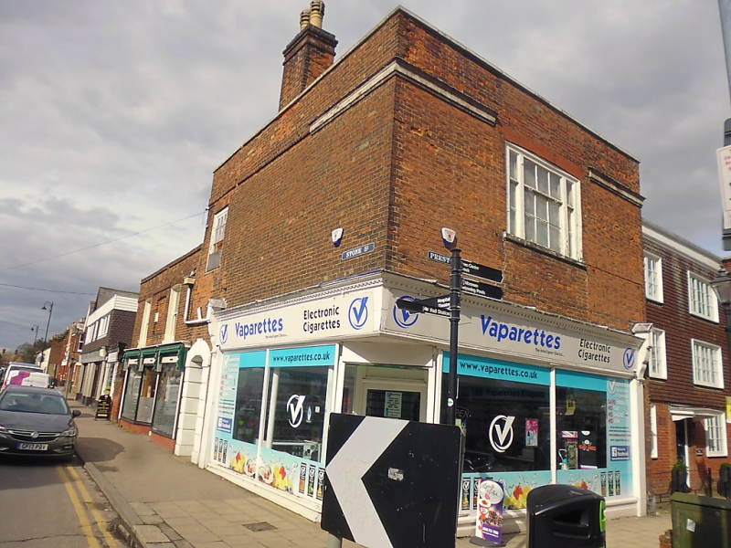
STONE STREET
1. ------------
1103
No 38
TH ol6l SE 3/59A
II GV
2.
This property is numbered in Stone Street, but its facade faces Preston
Street. C18. 2 storeys. 1 window. Red brick. Cornice and parapet.
Glazing barn intact above ground floor. Modern shop front. Rusticated
segmental-headed doorway on the South side. Projects beyond East
front of No 67 Preston Street.
No 38 forms a group with No 67 Preston Street.
Listing NGR: TR0155861146
External links are from the relevant listing authority and, where applicable, Wikidata. Wikidata IDs may be related buildings as well as this specific building. If you want to add or update a link, you will need to do so by editing the Wikidata entry.


Other nearby listed buildings
