Approximate Location Map
Large Map »
Latitude: 51.3161 / 51°18'57"N
Longitude: 0.8849 / 0°53'5"E
OS Eastings: 601138
OS Northings: 161394
OS Grid: TR011613
Mapcode National: GBR SW3.GJN
Mapcode Global: VHKJW.955X
Plus Code: 9F328V8M+CX
Entry Name: 50-52, Tanners Street
Listing Date: 3 August 1972
Grade: II
Source: Historic England
Source ID: 1069414
English Heritage Legacy ID: 176024
ID on this website: 101069414
Location: Davington, Swale, Kent, ME13
County: Kent
District: Swale
Civil Parish: Faversham
Built-Up Area: Faversham
Traditional County: Kent
Lieutenancy Area (Ceremonial County): Kent
Tagged with: Building
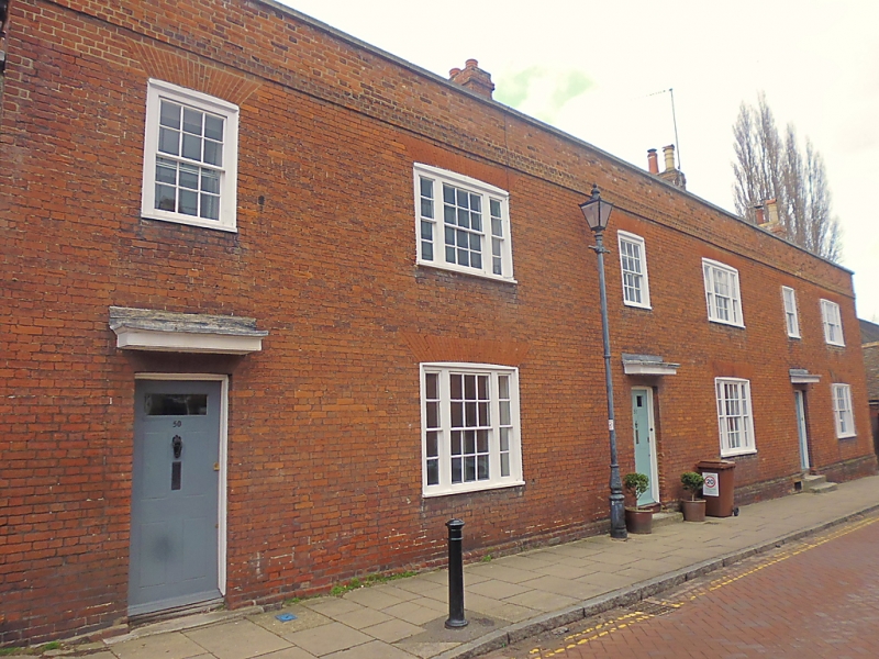
TANNERS STREET
1.
1103 (West Side)
--------------
Nos 50 to 52 (consec)
TR 0161 SW 2/161
II GV
2.
Circa 1770. 2 storeys. 6 windows. Red brick. Cornice and parapet. Windows
with cambered head linings and glazing bars intact. Doorways with small flat
hoods over. Built for officials of the Royal Gunpowder Factory.
Nos 46 to 52 (consec) form a group.
Listing NGR: TR0113261391
External links are from the relevant listing authority and, where applicable, Wikidata. Wikidata IDs may be related buildings as well as this specific building. If you want to add or update a link, you will need to do so by editing the Wikidata entry.


Other nearby listed buildings
