Approximate Location Map
Large Map »
Latitude: 51.3321 / 51°19'55"N
Longitude: 0.7082 / 0°42'29"E
OS Eastings: 588761
OS Northings: 162709
OS Grid: TQ887627
Mapcode National: GBR QS0.KVH
Mapcode Global: VHKJL.7S84
Plus Code: 9F328PJ5+V7
Entry Name: 241, Borden Lane
Listing Date: 27 November 1984
Grade: II
Source: Historic England
Source ID: 1185676
English Heritage Legacy ID: 176043
ID on this website: 101185676
Location: Harman's Corner, Swale, Kent, ME9
County: Kent
District: Swale
Civil Parish: Borden
Built-Up Area: Borden
Traditional County: Kent
Lieutenancy Area (Ceremonial County): Kent
Tagged with: Building
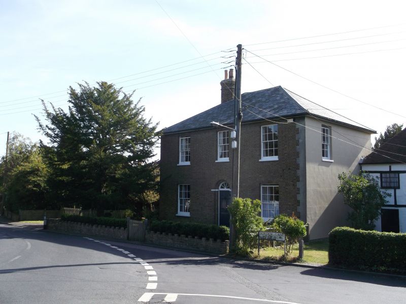
TQ 86 SE BORDEN BORDEN LANE
(east side)
5/39 No. 241
GV II
House. Early C19. White brick and slate roof. Two storeys and
hipped roof with stack to left. Three glazing bar sash windows on
first floor, 2 on ground floor, with central door of 6 raised
and fielded panels and semi-circular fanlight with gauged surround
on imposts. Included for group value only.
Listing NGR: TQ8876162703
External links are from the relevant listing authority and, where applicable, Wikidata. Wikidata IDs may be related buildings as well as this specific building. If you want to add or update a link, you will need to do so by editing the Wikidata entry.


Other nearby listed buildings
