Approximate Location Map
Large Map »
Latitude: 51.3568 / 51°21'24"N
Longitude: 0.6698 / 0°40'11"E
OS Eastings: 585987
OS Northings: 165348
OS Grid: TQ859653
Mapcode National: GBR QRL.VKC
Mapcode Global: VHJM3.K5G7
Plus Code: 9F329M49+PW
Entry Name: Parsonage Farm
Listing Date: 24 May 1973
Last Amended: 27 November 1984
Grade: II
Source: Historic England
Source ID: 1069351
English Heritage Legacy ID: 176177
ID on this website: 101069351
Location: Newington, Swale, Kent, ME9
County: Kent
District: Swale
Civil Parish: Newington
Built-Up Area: Newington
Traditional County: Kent
Lieutenancy Area (Ceremonial County): Kent
Tagged with: Building
TQ 86 NE NEWINGTON SCHOOL ROAD
(north side)
2/20 Parsonage Farm (Formerly listed
as the Cottage, Parsonage Farm)
24.5.73 II
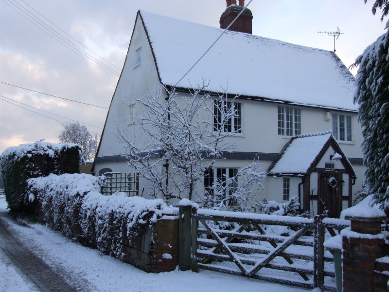
House. C17. Rendered brick with plain tiled roof. Two storeys
and garret on plinth with plat band and stack to rear centre.
Regular fenestration of 3 wood casements on first floor, 2 on
ground floor with plank and stud door in central gabled porch.
Listing NGR: TQ8594364413
External links are from the relevant listing authority and, where applicable, Wikidata. Wikidata IDs may be related buildings as well as this specific building. If you want to add or update a link, you will need to do so by editing the Wikidata entry.


Other nearby listed buildings
