Approximate Location Map
Large Map »
Latitude: 51.3242 / 51°19'27"N
Longitude: 0.7206 / 0°43'14"E
OS Eastings: 589653
OS Northings: 161859
OS Grid: TQ896618
Mapcode National: GBR QS1.WJ9
Mapcode Global: VHKJL.FZS7
Plus Code: 9F328PFC+M6
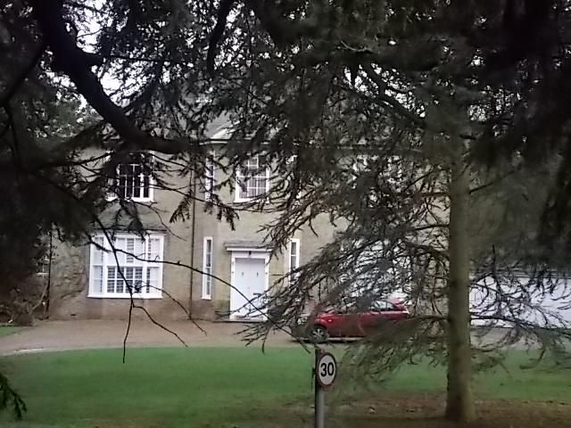
Entry Name: Cedar House
Listing Date: 27 November 1984
Grade: II
Source: Historic England
Source ID: 1343912
English Heritage Legacy ID: 176188
ID on this website: 101343912
Location: Tunstall, Swale, Kent, ME9
County: Kent
District: Swale
Civil Parish: Tunstall
Built-Up Area: Sittingbourne
Traditional County: Kent
Lieutenancy Area (Ceremonial County): Kent
Tagged with: House
TQ 86 SE TUNSTALL TUNSTALL ROAD
(east side)
5/61 Cedar House
II
Former Rectory. c. 1830. White brick and slate roof. Two storeys
and eaves cornice to hipped roof. Central canted projection.
5 glazing bar sashes to first floor, segmented bays to left and
right on ground floor, with central double doors of 2 fielded
panels and narrow sidelights, with cornice hood on consoles.
Listing NGR: TQ8965461862
External links are from the relevant listing authority and, where applicable, Wikidata. Wikidata IDs may be related buildings as well as this specific building. If you want to add or update a link, you will need to do so by editing the Wikidata entry.


Other nearby listed buildings
