Approximate Location Map
Large Map »
Latitude: 51.3082 / 51°18'29"N
Longitude: 0.8697 / 0°52'10"E
OS Eastings: 600110
OS Northings: 160477
OS Grid: TR001604
Mapcode National: GBR RTR.YH0
Mapcode Global: VHKJW.1C3Z
Plus Code: 9F328V59+7V
Entry Name: Carthouse 20 Metres West of Queen Court
Listing Date: 27 August 1985
Grade: II
Source: Historic England
Source ID: 1069190
English Heritage Legacy ID: 176510
ID on this website: 101069190
Location: Ospringe, Swale, Kent, ME13
County: Kent
District: Swale
Civil Parish: Ospringe
Built-Up Area: Faversham
Traditional County: Kent
Lieutenancy Area (Ceremonial County): Kent
Tagged with: Building Thatched building
TR 06 SW OSPRINGE WATER LANE
(west side)
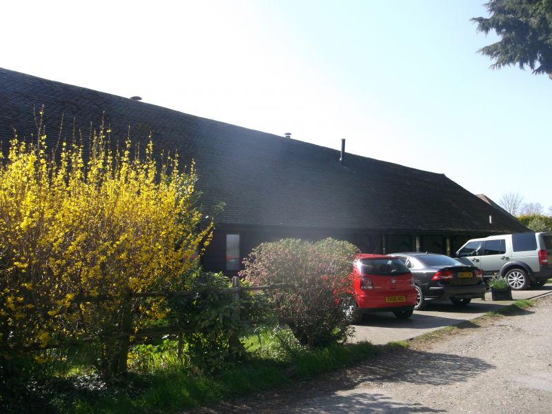
Carthouse
2/104 20 metres
west of
27.8 85 Queen Court
GV II
Carthouse. C18.Timber framed and weather boarded with some
red brick cladding, and thatched roof. Ten framed bays,
one storey and hipped roof. Open arcaded front, with 2 closed
bays at either end. Interior: queen strut roof with clasped
purlins.
Listing NGR: TR0008960195
External links are from the relevant listing authority and, where applicable, Wikidata. Wikidata IDs may be related buildings as well as this specific building. If you want to add or update a link, you will need to do so by editing the Wikidata entry.


Other nearby listed buildings
