Approximate Location Map
Large Map »
Latitude: 51.2516 / 51°15'5"N
Longitude: 0.8024 / 0°48'8"E
OS Eastings: 595659
OS Northings: 154004
OS Grid: TQ956540
Mapcode National: GBR RVF.KN5
Mapcode Global: VHKK0.VSJW
Plus Code: 9F327R22+MW
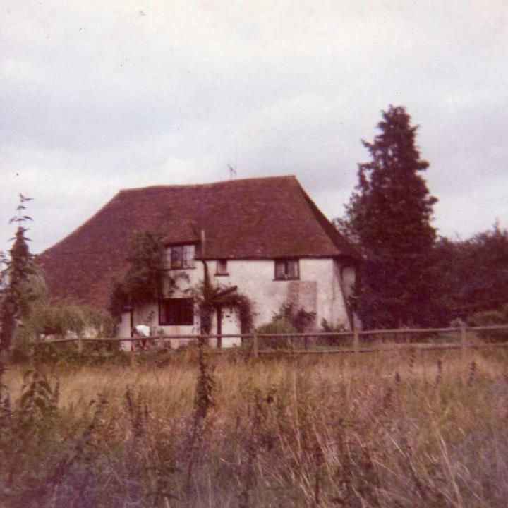
Entry Name: Valley Farm House
Listing Date: 24 January 1967
Grade: II
Source: Historic England
Source ID: 1203290
English Heritage Legacy ID: 176544
ID on this website: 101203290
Location: The Valley, Swale, Kent, ME13
County: Kent
District: Swale
Civil Parish: Stalisfield
Traditional County: Kent
Lieutenancy Area (Ceremonial County): Kent
Tagged with: Farmhouse
TQ 95 SE STALISFIELD STALISFIELD
ROAD
(west side)
6/138 Valley Farm
House
24.1.67
GV II
House. C16. Timber framed and clad with painted brick, with
exposed timber frame to rear. Plain tiled roof. Two storeys
and hipped roof with hipped dormer and stack to rear. Irregular
fenestration of wooden casements with boarded door to left of
large central brick buttress, and boarded door to left in
catslide outshot.
Listing NGR: TQ9565954004
External links are from the relevant listing authority and, where applicable, Wikidata. Wikidata IDs may be related buildings as well as this specific building. If you want to add or update a link, you will need to do so by editing the Wikidata entry.


Other nearby listed buildings
