Approximate Location Map
Large Map »
Latitude: 51.2227 / 51°13'21"N
Longitude: 1.404 / 1°24'14"E
OS Eastings: 637788
OS Northings: 152558
OS Grid: TR377525
Mapcode National: GBR X1Y.7SM
Mapcode Global: VHMDG.9J3K
Plus Code: 9F336CF3+3J
Entry Name: 11 and 13, Beach Street
Listing Date: 8 February 1974
Grade: II
Source: Historic England
Source ID: 1069910
English Heritage Legacy ID: 176941
ID on this website: 101069910
Location: Deal, Dover, Kent, CT14
County: Kent
District: Dover
Civil Parish: Deal
Built-Up Area: Deal
Traditional County: Kent
Lieutenancy Area (Ceremonial County): Kent
Tagged with: Building
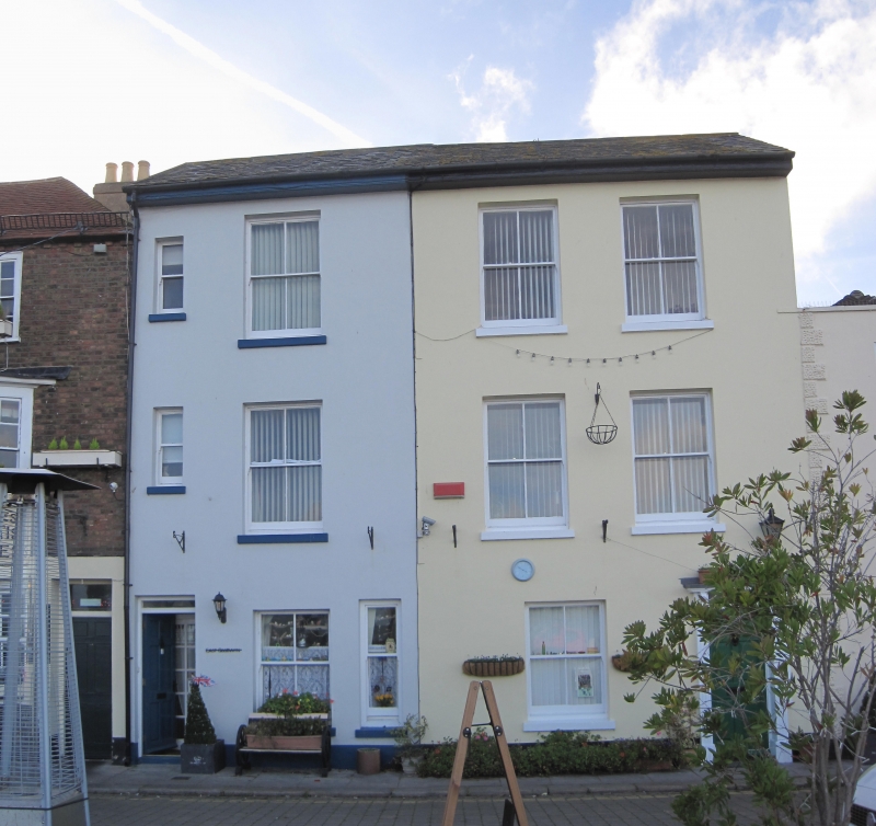
BEACH STREET
1.
1035
(West Side)
Nos 11 and 13
TR 3752 NE 1/181
II GV
2.
Mid C19 pair. 3 storeys stuccoed. Slate roof. 2 sashes with verticals only
to each. Simple doorcases. Included for group value only.
Nos 1 to 19 (odd) form a group.
Listing NGR: TR3778852558
External links are from the relevant listing authority and, where applicable, Wikidata. Wikidata IDs may be related buildings as well as this specific building. If you want to add or update a link, you will need to do so by editing the Wikidata entry.


Other nearby listed buildings
