Approximate Location Map
Large Map »
Latitude: 51.2234 / 51°13'24"N
Longitude: 1.4042 / 1°24'15"E
OS Eastings: 637795
OS Northings: 152642
OS Grid: TR377526
Mapcode National: GBR X1Y.7TG
Mapcode Global: VHMDG.9H6Z
Plus Code: 9F336CF3+9M
Entry Name: Beachbrow Private Hotel
Listing Date: 1 June 1949
Grade: II
Source: Historic England
Source ID: 1250325
English Heritage Legacy ID: 176945
Also known as: The Beachbrow Hotel, Deal
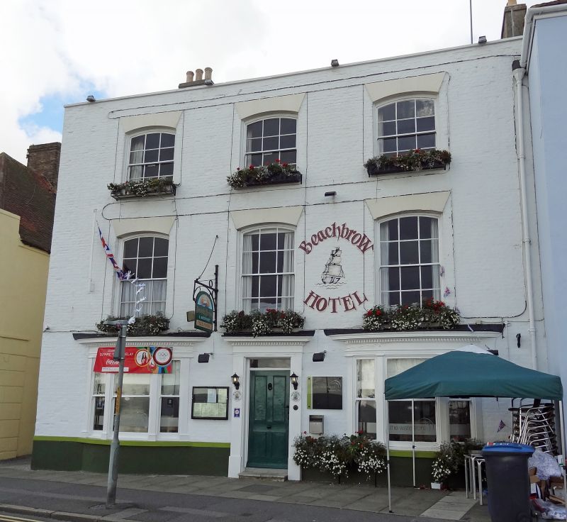
Beachbrow Hotel
ID on this website: 101250325
BEACH STREET
1.
lO35
(West Side)
No 29
(Beach brow Private
TR 3752 NE 1/10 1.6.49. Hotel)
II GV
2.
C18. 3 storeys painted brick. Tripped slate roof. Stone coping and parapet.
3 sashes with segmental heads. 2 large 3-light bow windows on ground floor with
glazing bars missing. Doorcase with plain pilasters and entablature.
Nos 25 to 31 (odd) and Nos 35 and 37 form a group.
Listing NGR: TR3779552642
External links are from the relevant listing authority and, where applicable, Wikidata. Wikidata IDs may be related buildings as well as this specific building. If you want to add or update a link, you will need to do so by editing the Wikidata entry.


Other nearby listed buildings
