Approximate Location Map
Large Map »
Latitude: 51.2239 / 51°13'26"N
Longitude: 1.4041 / 1°24'14"E
OS Eastings: 637787
OS Northings: 152700
OS Grid: TR377527
Mapcode National: GBR X1Y.7T8
Mapcode Global: VHMDG.9H5L
Plus Code: 9F336CF3+HM
Entry Name: 49, Beach Street
Listing Date: 8 February 1974
Grade: II
Source: Historic England
Source ID: 1263303
English Heritage Legacy ID: 176947
ID on this website: 101263303
Location: Deal, Dover, Kent, CT14
County: Kent
District: Dover
Civil Parish: Deal
Built-Up Area: Deal
Traditional County: Kent
Lieutenancy Area (Ceremonial County): Kent
Tagged with: Building
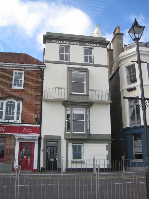
BEACH STREET
1.
lO35
(West Side)
No 49
TR 3752 NE 1/189
II GV
2.
Mid C19. 4 storeys stuccoed. Parapet and moulded eaves cornice. 2 sashes.
3-light bay to 1st floor. Ground floor has left side doorcase with rosette frieze
and architrave. Shopfront with 3 pilasters.
Nos 49 o 55 (odd) form a group.
Listing NGR: TR3778752700
External links are from the relevant listing authority and, where applicable, Wikidata. Wikidata IDs may be related buildings as well as this specific building. If you want to add or update a link, you will need to do so by editing the Wikidata entry.


Other nearby listed buildings
