Approximate Location Map
Large Map »
Latitude: 51.2265 / 51°13'35"N
Longitude: 1.4042 / 1°24'15"E
OS Eastings: 637777
OS Northings: 152982
OS Grid: TR377529
Mapcode National: GBR X1Y.1TG
Mapcode Global: VHMDG.9F5N
Plus Code: 9F336CG3+HM
Entry Name: 123, Beach Street
Listing Date: 8 February 1974
Last Amended: 8 May 1974
Grade: II
Source: Historic England
Source ID: 1363431
English Heritage Legacy ID: 176970
ID on this website: 101363431
Location: Deal, Dover, Kent, CT14
County: Kent
District: Dover
Civil Parish: Deal
Built-Up Area: Deal
Traditional County: Kent
Lieutenancy Area (Ceremonial County): Kent
Tagged with: Building
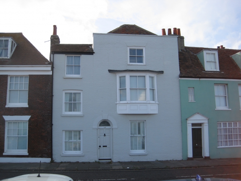
BEACH STREET
1.
1035
(West Side)
No 123
TR 3752 NE 1/24
II
GV
2 .
Early C19. 3 stores painted brick. Part hipped tiled roof, part slate roof.
2 sashes with glazing bars missing and large bay window on 1st floor. Round-
headed doorcase with keystone and plain fanlight.
Nos 119 to 127 (odd) form a group.
Listing NGR: TR3777752982
External links are from the relevant listing authority and, where applicable, Wikidata. Wikidata IDs may be related buildings as well as this specific building. If you want to add or update a link, you will need to do so by editing the Wikidata entry.


Other nearby listed buildings
