Approximate Location Map
Large Map »
Latitude: 51.2269 / 51°13'36"N
Longitude: 1.4042 / 1°24'14"E
OS Eastings: 637774
OS Northings: 153033
OS Grid: TR377530
Mapcode National: GBR X1Y.1T9
Mapcode Global: VHMDG.9F59
Plus Code: 9F336CG3+QM
Entry Name: Fairhaven
Listing Date: 8 February 1974
Grade: II
Source: Historic England
Source ID: 1069882
English Heritage Legacy ID: 176976
ID on this website: 101069882
Location: Deal, Dover, Kent, CT14
County: Kent
District: Dover
Civil Parish: Deal
Built-Up Area: Deal
Traditional County: Kent
Lieutenancy Area (Ceremonial County): Kent
Tagged with: Building
BEACH STREET
1.
lO35
(West Side)
No 137
(Fairhaven)
TR 3753 SE 2/28
II GV
2.
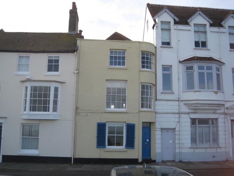
C18. 3 storeys painted brick. Tiled roof. 2 sashes. The right hand window
and door below it comprise a flattened bow squeezed in between the next house.
Included for group value.
Nos 129 to 137 (odd) and Nos 141 and 143 form a group.
Listing NGR: TR3777453033
External links are from the relevant listing authority and, where applicable, Wikidata. Wikidata IDs may be related buildings as well as this specific building. If you want to add or update a link, you will need to do so by editing the Wikidata entry.


Other nearby listed buildings
