Approximate Location Map
Large Map »
Latitude: 51.2273 / 51°13'38"N
Longitude: 1.4041 / 1°24'14"E
OS Eastings: 637771
OS Northings: 153078
OS Grid: TR377530
Mapcode National: GBR X1R.V52
Mapcode Global: VHMDG.9D5Z
Plus Code: 9F336CG3+WM
Entry Name: Central House
Listing Date: 8 February 1974
Grade: II
Source: Historic England
Source ID: 1069885
English Heritage Legacy ID: 176980
ID on this website: 101069885
Location: Deal, Dover, Kent, CT14
County: Kent
District: Dover
Civil Parish: Deal
Built-Up Area: Deal
Traditional County: Kent
Lieutenancy Area (Ceremonial County): Kent
Tagged with: House
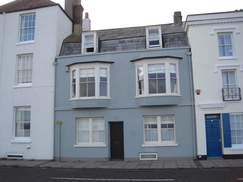
BEACH STREET
1.
1035
(West Side)
No 147
(Central House)
TR 3753 SE 2/206
II GV
2.
Circa 1860. 2 storeys stuccoed. Slate mansard roof with 2 dormers. 2 3-light
bays on 1st floor with altered glazing. The ground floor has 2 double-hung sashes
and a central doorcase with keystone.
Nos 145 to 155 (odd) form a group.
Listing NGR: TR3777153078
External links are from the relevant listing authority and, where applicable, Wikidata. Wikidata IDs may be related buildings as well as this specific building. If you want to add or update a link, you will need to do so by editing the Wikidata entry.


Other nearby listed buildings
