Approximate Location Map
Large Map »
Latitude: 51.2275 / 51°13'38"N
Longitude: 1.4041 / 1°24'14"E
OS Eastings: 637770
OS Northings: 153092
OS Grid: TR377530
Mapcode National: GBR X1R.V50
Mapcode Global: VHMDG.9D5W
Plus Code: 9F336CG3+XM
Entry Name: The Pelican
Listing Date: 8 February 1974
Grade: II
Source: Historic England
Source ID: 1363433
English Heritage Legacy ID: 176983
ID on this website: 101363433
Location: Deal, Dover, Kent, CT14
County: Kent
District: Dover
Civil Parish: Deal
Built-Up Area: Deal
Traditional County: Kent
Lieutenancy Area (Ceremonial County): Kent
Tagged with: Architectural structure
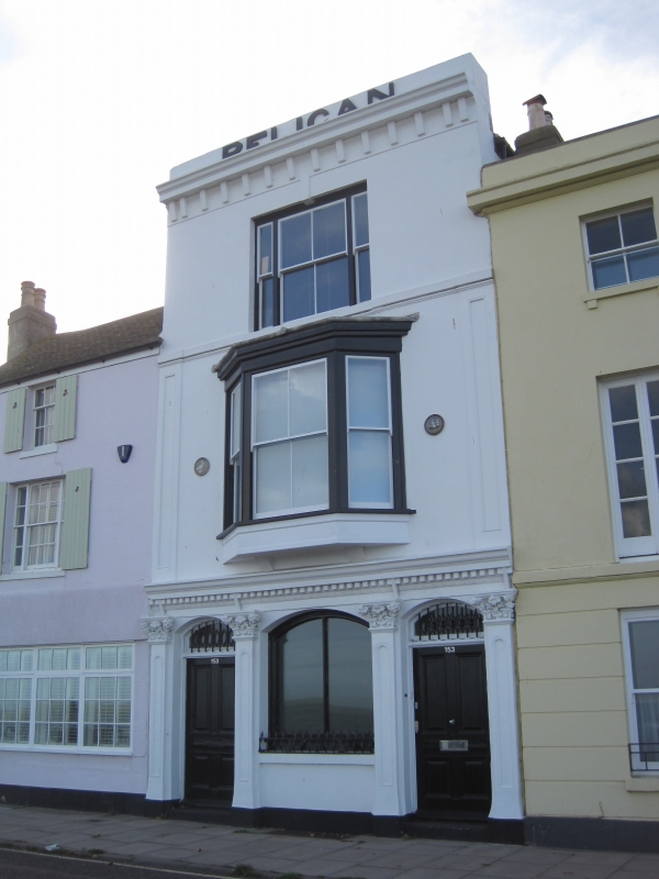
BEACH STREET
1.
1035
(West Side)
No 153
(The Pelican)
TR 3753 SE 2/209
II GV
2.
Mid C19. 3 storeys stuccoed. Parapet and moulded eaves cornice. 1 3-light
sash on the 2nd floor. 1 3-light bay on ground and 1st floors. Victorian pub
front with 4 pilasters.
Nos 145 to 155 (odd) form a group.
Listing NGR: TR3777053092
External links are from the relevant listing authority and, where applicable, Wikidata. Wikidata IDs may be related buildings as well as this specific building. If you want to add or update a link, you will need to do so by editing the Wikidata entry.


Other nearby listed buildings
