Approximate Location Map
Large Map »
Latitude: 51.2289 / 51°13'44"N
Longitude: 1.4044 / 1°24'15"E
OS Eastings: 637777
OS Northings: 153257
OS Grid: TR377532
Mapcode National: GBR X1R.V5S
Mapcode Global: VHMDG.9C8R
Plus Code: 9F336CH3+HP
Entry Name: 191, Beach Street
Listing Date: 8 February 1974
Grade: II
Source: Historic England
Source ID: 1069892
English Heritage Legacy ID: 176998
ID on this website: 101069892
Location: Deal, Dover, Kent, CT14
County: Kent
District: Dover
Civil Parish: Deal
Built-Up Area: Deal
Traditional County: Kent
Lieutenancy Area (Ceremonial County): Kent
Tagged with: Building
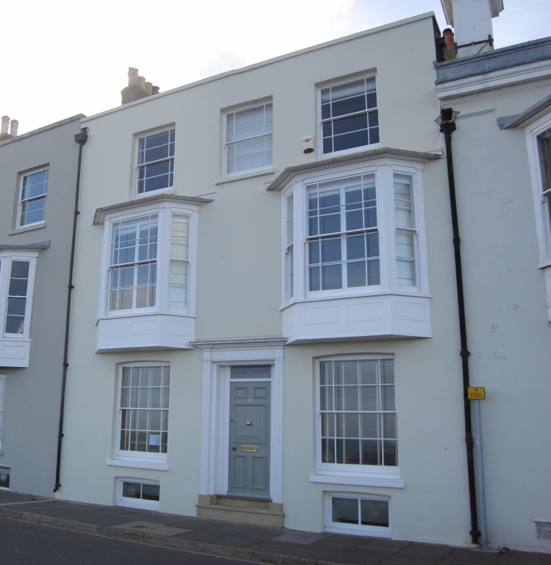
1.
1035
TR 3753 SE
2/35A
BEACH STREET
(West Side)
No 191
II
GV
2.
Early C19. 3 storeys and basement stuccoed. Hipped tiled roof. 2nd floor has
3 sashes with glazing bars intact. 1st floor has 2 1-light canted bays. Ground
floor has 2 sashes with shutters and a central doorcase with cornice, pilasters
and panelled reveals and rectangular fanlight.
No 183 to 199 (odd) form a group.
Listing NGR: TR3777753257
External links are from the relevant listing authority and, where applicable, Wikidata. Wikidata IDs may be related buildings as well as this specific building. If you want to add or update a link, you will need to do so by editing the Wikidata entry.


Other nearby listed buildings
