Approximate Location Map
Large Map »
Latitude: 51.229 / 51°13'44"N
Longitude: 1.4043 / 1°24'15"E
OS Eastings: 637775
OS Northings: 153265
OS Grid: TR377532
Mapcode National: GBR X1R.V5R
Mapcode Global: VHMDG.9C8P
Plus Code: 9F336CH3+JP
Entry Name: Forres House
Listing Date: 8 February 1974
Grade: II
Source: Historic England
Source ID: 1250763
English Heritage Legacy ID: 176999
ID on this website: 101250763
Location: Deal, Dover, Kent, CT14
County: Kent
District: Dover
Civil Parish: Deal
Built-Up Area: Deal
Traditional County: Kent
Lieutenancy Area (Ceremonial County): Kent
Tagged with: House
1.
1035
TR 3753 SE
2/216
BEACH STREET
(West Side)
No 193
(Forres House)
II
GV
2.
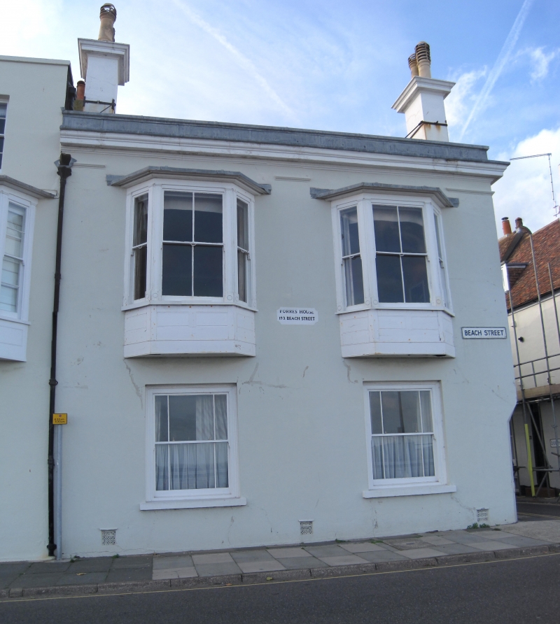
Mid C19. 2 storeys and basement stuccoed. Parapet and moulded cornice. 2 1-light
canted bays to 1st floor and 2 altered windows on ground floor. Side elevation
has 4 sashes, one of which is blank, and a round-headed doorcase. Included for
group value.
No 183 to 199 (odd) form a group.
Listing NGR: TR3777553265
External links are from the relevant listing authority and, where applicable, Wikidata. Wikidata IDs may be related buildings as well as this specific building. If you want to add or update a link, you will need to do so by editing the Wikidata entry.


Other nearby listed buildings
