Approximate Location Map
Large Map »
Latitude: 51.2262 / 51°13'34"N
Longitude: 1.4035 / 1°24'12"E
OS Eastings: 637735
OS Northings: 152946
OS Grid: TR377529
Mapcode National: GBR X1Y.1P5
Mapcode Global: VHMDG.8FVW
Plus Code: 9F336CG3+FC
Entry Name: 1, Brewer Street
Listing Date: 8 February 1974
Grade: II
Source: Historic England
Source ID: 1069896
English Heritage Legacy ID: 177009
ID on this website: 101069896
Location: Deal, Dover, Kent, CT14
County: Kent
District: Dover
Civil Parish: Deal
Built-Up Area: Deal
Traditional County: Kent
Lieutenancy Area (Ceremonial County): Kent
Tagged with: Building
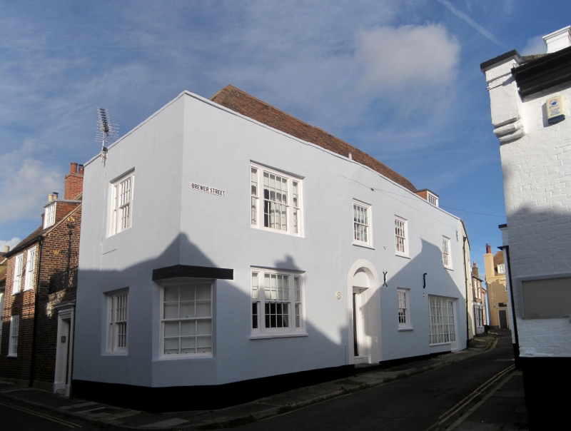
BREWER STREET
1.
1035
(North West Side)
No 1
TR 3752 NE 1/224
II GV
2.
An early C19 industrial building. 2 storeys stuccoed. 1 dormer. Parapet with
stone coping. 4 sashes with glazing bars intact and 1 3-light sash. Simple
round-headed doorcase. Included for group value.
Nos 1 to 6 (consec) form a group.
Listing NGR: TR3773552946
External links are from the relevant listing authority and, where applicable, Wikidata. Wikidata IDs may be related buildings as well as this specific building. If you want to add or update a link, you will need to do so by editing the Wikidata entry.


Other nearby listed buildings
