Approximate Location Map
Large Map »
Latitude: 51.2036 / 51°12'13"N
Longitude: 1.3862 / 1°23'10"E
OS Eastings: 636643
OS Northings: 150386
OS Grid: TR366503
Mapcode National: GBR X23.H97
Mapcode Global: VHLH5.Z06M
Plus Code: 9F33693P+FF
Entry Name: Walmer Court
Listing Date: 1 June 1949
Grade: II
Source: Historic England
Source ID: 1069860
English Heritage Legacy ID: 177025
ID on this website: 101069860
Location: Upper Walmer, Dover, Kent, CT14
County: Kent
District: Dover
Civil Parish: Walmer
Built-Up Area: Deal
Traditional County: Kent
Lieutenancy Area (Ceremonial County): Kent
Tagged with: Building
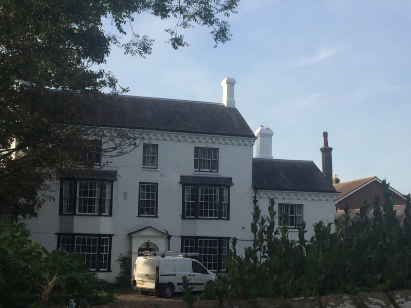
1. CHURCH STREET
1035
WALMER
Walmer Court
TR 35 SE 5/166 1.6.49.
II
2.
C18. 3 storeys stuccoed. Slate roof. Eaves cornice with modillions. 2 3-light
bow windows on the ground and first floors with a dentilled cornice over them.
Doorcase with fluted pilasters and pediment. Lower wing of 2 storeys and 1 window
to the East end addition with sloping roof to the West. The back door dates
from the C17 with a glazed peephole in it.
Listing NGR: TR3665650376
External links are from the relevant listing authority and, where applicable, Wikidata. Wikidata IDs may be related buildings as well as this specific building. If you want to add or update a link, you will need to do so by editing the Wikidata entry.


Other nearby listed buildings
