Approximate Location Map
Large Map »
Latitude: 51.2265 / 51°13'35"N
Longitude: 1.4036 / 1°24'13"E
OS Eastings: 637740
OS Northings: 152986
OS Grid: TR377529
Mapcode National: GBR X1Y.1P1
Mapcode Global: VHMDG.8FXL
Plus Code: 9F336CG3+JF
Entry Name: 17, Coppin Street
Listing Date: 8 February 1974
Grade: II
Source: Historic England
Source ID: 1363425
English Heritage Legacy ID: 177043
ID on this website: 101363425
Location: Deal, Dover, Kent, CT14
County: Kent
District: Dover
Civil Parish: Deal
Built-Up Area: Deal
Traditional County: Kent
Lieutenancy Area (Ceremonial County): Kent
Tagged with: Building
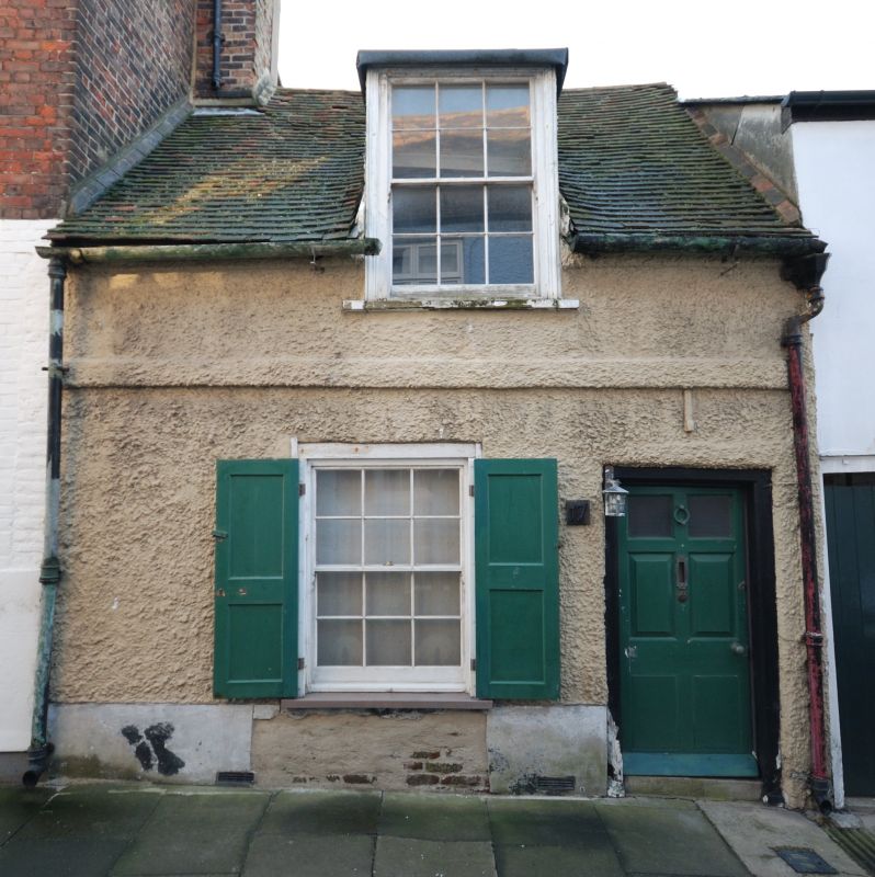
1. COPPIN STREET
1035
(South Side)
No 17
TR 3752 NE 1/245
II GV
2.
Late C17 to early C18 refaced in the early C19. 1½ storeys, bars in-tact. Renewed
tiled roof with 1 dormer. Stringcourse. 1 sash with glazing bars intact. Sinmple
doorcase. The interir contains an inglenook fireplace.
Nos 16 and 17 form a group.
Listing NGR: TR3774052986
External links are from the relevant listing authority and, where applicable, Wikidata. Wikidata IDs may be related buildings as well as this specific building. If you want to add or update a link, you will need to do so by editing the Wikidata entry.


Other nearby listed buildings
