Approximate Location Map
Large Map »
Latitude: 51.2026 / 51°12'9"N
Longitude: 1.3902 / 1°23'24"E
OS Eastings: 636926
OS Northings: 150281
OS Grid: TR369502
Mapcode National: GBR X23.J9M
Mapcode Global: VHMDN.11TF
Plus Code: 9F33693R+23
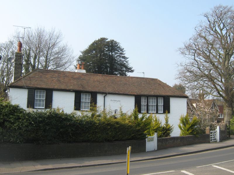
Entry Name: The Rattling Cat
Listing Date: 1 June 1949
Grade: II
Source: Historic England
Source ID: 1069831
English Heritage Legacy ID: 177062
ID on this website: 101069831
Location: Upper Walmer, Dover, Kent, CT14
County: Kent
District: Dover
Civil Parish: Walmer
Built-Up Area: Deal
Traditional County: Kent
Lieutenancy Area (Ceremonial County): Kent
Tagged with: Building
DOVER ROAD
1.
1035
WALMER
No 277
(The Rattling Cat)
TR 35 SE 5/159 1.6.49.
II GV
2.
C18. 2 storeys painted brick. 3 sashes with glazing bars intact. Venetian
shrutters on 1st floor. Solid wooden shutters on ground floor. Ground floor
windows have cambered head linings. Doorcase with Doric pilasters, pediment,
semi-circular fanlight and 6 panel moulded door.
No 277 and 279 form a group.
Listing NGR: TR3692650281
External links are from the relevant listing authority and, where applicable, Wikidata. Wikidata IDs may be related buildings as well as this specific building. If you want to add or update a link, you will need to do so by editing the Wikidata entry.


Other nearby listed buildings
