Approximate Location Map
Large Map »
Latitude: 51.2272 / 51°13'37"N
Longitude: 1.4033 / 1°24'12"E
OS Eastings: 637716
OS Northings: 153056
OS Grid: TR377530
Mapcode National: GBR X1R.TXC
Mapcode Global: VHMDG.8FR3
Plus Code: 9F336CG3+V8
Entry Name: Vargas House
Listing Date: 8 February 1974
Grade: II
Source: Historic England
Source ID: 1069835
English Heritage Legacy ID: 177069
ID on this website: 101069835
Location: Deal, Dover, Kent, CT14
County: Kent
District: Dover
Civil Parish: Deal
Built-Up Area: Deal
Traditional County: Kent
Lieutenancy Area (Ceremonial County): Kent
Tagged with: House
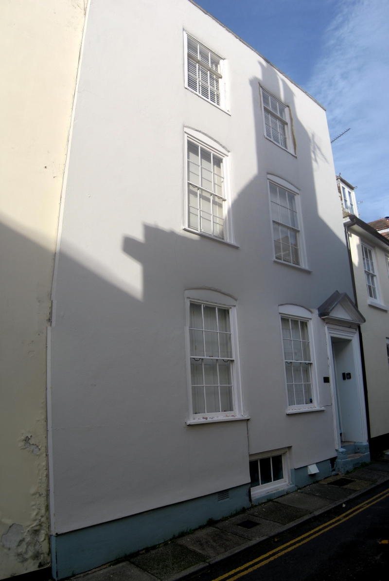
FARRIER STREET
1.
1055
(North Side)
No 9
(Vargas House )
TR 3573 SE 2/72
II GV
2.
Late C18 to early C19. 2 storeys and basement pebble dashed. Parapet. 2 sashes.
Those on the lower floors have glazing bars intact and cambered heads. Right
side doorcase with pediment, moulded architrave and 6 panelled door, the top
2 panels cut away and glazed, 2 steps to street.
Nos 9 to 25 (odd) forma group.
Listing NGR: TR3771653056
External links are from the relevant listing authority and, where applicable, Wikidata. Wikidata IDs may be related buildings as well as this specific building. If you want to add or update a link, you will need to do so by editing the Wikidata entry.


Other nearby listed buildings
