Approximate Location Map
Large Map »
Latitude: 51.227 / 51°13'37"N
Longitude: 1.4035 / 1°24'12"E
OS Eastings: 637727
OS Northings: 153039
OS Grid: TR377530
Mapcode National: GBR X1Y.1MS
Mapcode Global: VHMDG.8FT7
Plus Code: 9F336CG3+Q9
Entry Name: The Deal Lugger
Listing Date: 8 February 1974
Grade: II
Source: Historic England
Source ID: 1069841
English Heritage Legacy ID: 177078
ID on this website: 101069841
Location: Deal, Dover, Kent, CT14
County: Kent
District: Dover
Civil Parish: Deal
Built-Up Area: Deal
Traditional County: Kent
Lieutenancy Area (Ceremonial County): Kent
Tagged with: Building
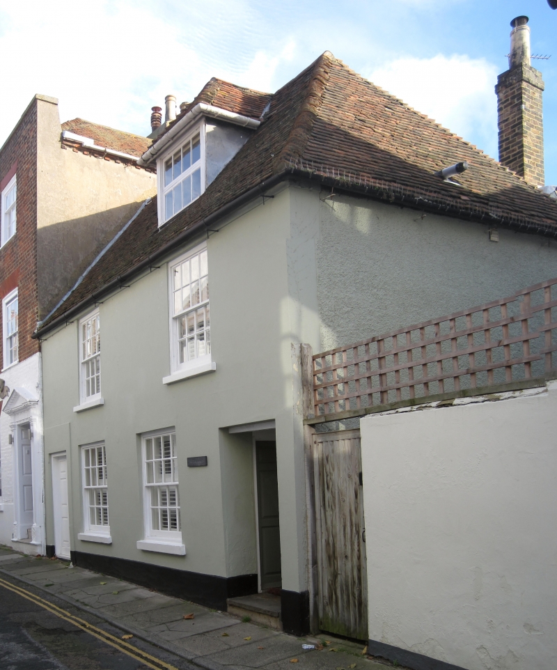
FARRIER STREET
1.
1035
(South Side)
No 6
(The Deal Lugger)
TR 3753 SE 2/265
II GV
2.
bite C18 to early C19. 2 storeys and attics stuccoed. Hipped tiled roof with
1 dormer. 2 sashes with verticals only. Left side doorcase with 6 panelled
door, the top 4 panels cut away and glazed. Yard entrance on right side.
Nos 6 to 24 (even) form a group.
Listing NGR: TR3772753039
External links are from the relevant listing authority and, where applicable, Wikidata. Wikidata IDs may be related buildings as well as this specific building. If you want to add or update a link, you will need to do so by editing the Wikidata entry.


Other nearby listed buildings
